Vietnam
A long coastal corridor between two river deltas
Nations 15

The Geography
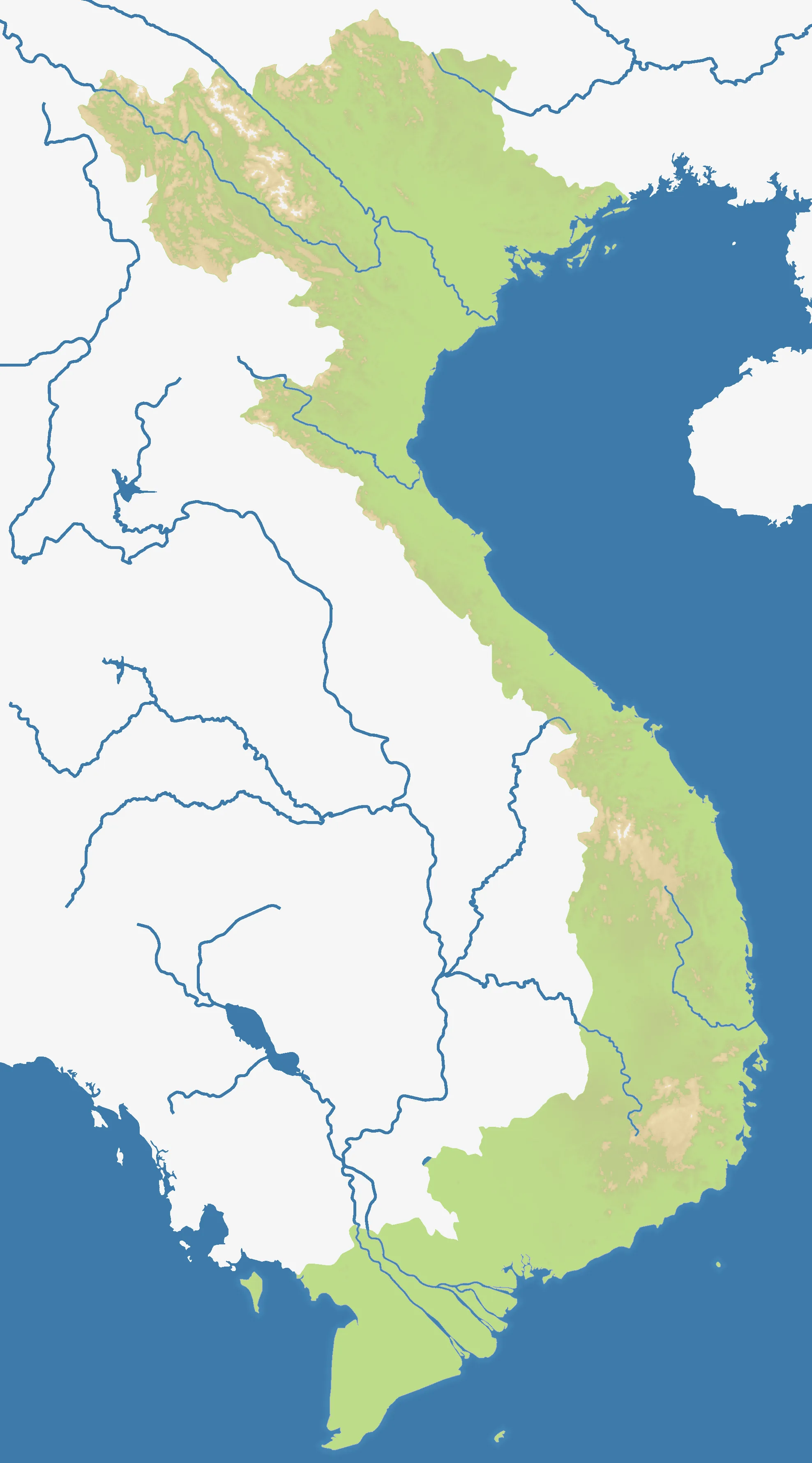
Vietnam is a narrow, elongated country on the eastern edge of mainland Southeast Asia. Its coastline runs from the Gulf of Tonkin in the north to the Mekong Delta in the south, while the Annamite Range forms a rugged spine inland. The Red River Delta and Mekong Delta are broad lowlands separated by a long chain of mountains, plateaus, and smaller coastal plains.
The map follows that north–south shape. Hanoi, Hai Phong, and the northern provinces sit around the Red River basin; Hue, Da Nang, and Quang Tri occupy the central corridor; and Saigon, Can Tho, and the Mekong provinces anchor the south. Offshore positions such as Phu Quoc add a maritime flank to an otherwise continuous mainland theatre.
In gameplay terms, Vietnam is a map of distance and compression. The coast is a fast route between separated theatres, but the narrow central section can turn every inland crossing into a contested gateway.
The History
Nineteenth century — French colonial rule
During the nineteenth century, France established colonial control over Vietnam and incorporated it into French Indochina. Colonial administration and infrastructure reshaped the major cities, ports, and agricultural regions.
1945 — Declaration of independence
Following the end of the Second World War and the collapse of Japanese occupation, Hồ Chí Minh declared Vietnamese independence. The declaration began a period of conflict over the country’s political future.
1954 — Division after the First Indochina War
The First Indochina War ended with the Geneva Accords. Vietnam was divided provisionally at the 17th parallel, creating northern and southern political administrations while a later nationwide settlement remained unresolved.
1975 — Reunification
The Vietnam War ended in 1975 with the fall of Saigon. Vietnam was subsequently reunified as a single state, with Hanoi as its capital.
The Battlefield
Terrain Overview
Vietnam rewards control of a connected chain rather than a single large heartland. The north and south offer wider delta regions, while the central belt is narrower and more exposed. Coastal access links the map’s length, but mountain and plateau regions can slow movement between the shoreline and interior.
Best Spawns
- Red River basin — access to Hanoi, Hai Phong, and several northern approaches
- Central coast — a compact position near Hue, Da Nang, and the principal north–south corridor
- Mekong Delta — room to expand around Saigon, Can Tho, and the southern waterways
Avoid
- The far end of the peninsula — distance can leave a remote start isolated from the main contest
- Exposed central crossings — a narrow position can be surrounded when both northern and southern fronts converge
- Offshore outposts without support — islands are useful staging points but difficult to reinforce alone
Strategic Insights
Treat Vietnam as two linked campaigns. Secure a local delta or coastal cluster first, then use the central corridor and naval routes to decide where the next front opens. The side that protects its long supply line can turn the country’s narrow shape into an advantage.
Fun Facts
- Vietnam’s two major deltas — the Red River and Mekong — are among its most densely settled agricultural regions
- The Annamite Range continues along much of the country’s western interior
- The map includes provinces and cities from the northern highlands, central coast, and Mekong region, rather than reducing Vietnam to a single urban front