Northwest Passage
Arctic routes through a frozen archipelago
Nations 21
The Geography
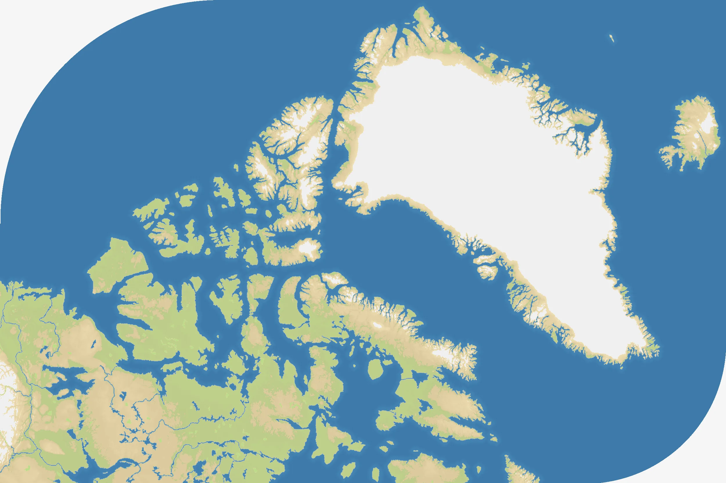
Northwest Passage spans Greenland, Iceland and the Canadian Arctic Archipelago across a wide 2500×1664 field. Islands, fjords and channels dominate a map with only 38% land and 21 remote northern starts. The geography is vast but fragmented: large icebound landmasses sit beside chains of small islands separated by narrow seas.
The History
Inuit communities knew and travelled these Arctic waters long before European expeditions searched for a shortcut to Asia. Franklin’s 1845 voyage ended in disaster; Roald Amundsen completed the first recorded full transit in 1903–1906, and shrinking sea ice has since increased modern access.
The Battlefield
Naval mobility determines whether isolated regions can support one another. Greenland provides a large base, while the Canadian islands offer many stepping stones but few continuous fronts. Chokepoints can close whole routes, yet holding too many islands spreads forces thin. Consolidate a cluster, establish ports in successive channels and deny the crossings that connect your rivals’ archipelagos.