Germany
Sixteen states in the heart of Europe
Nations 16





The Geography
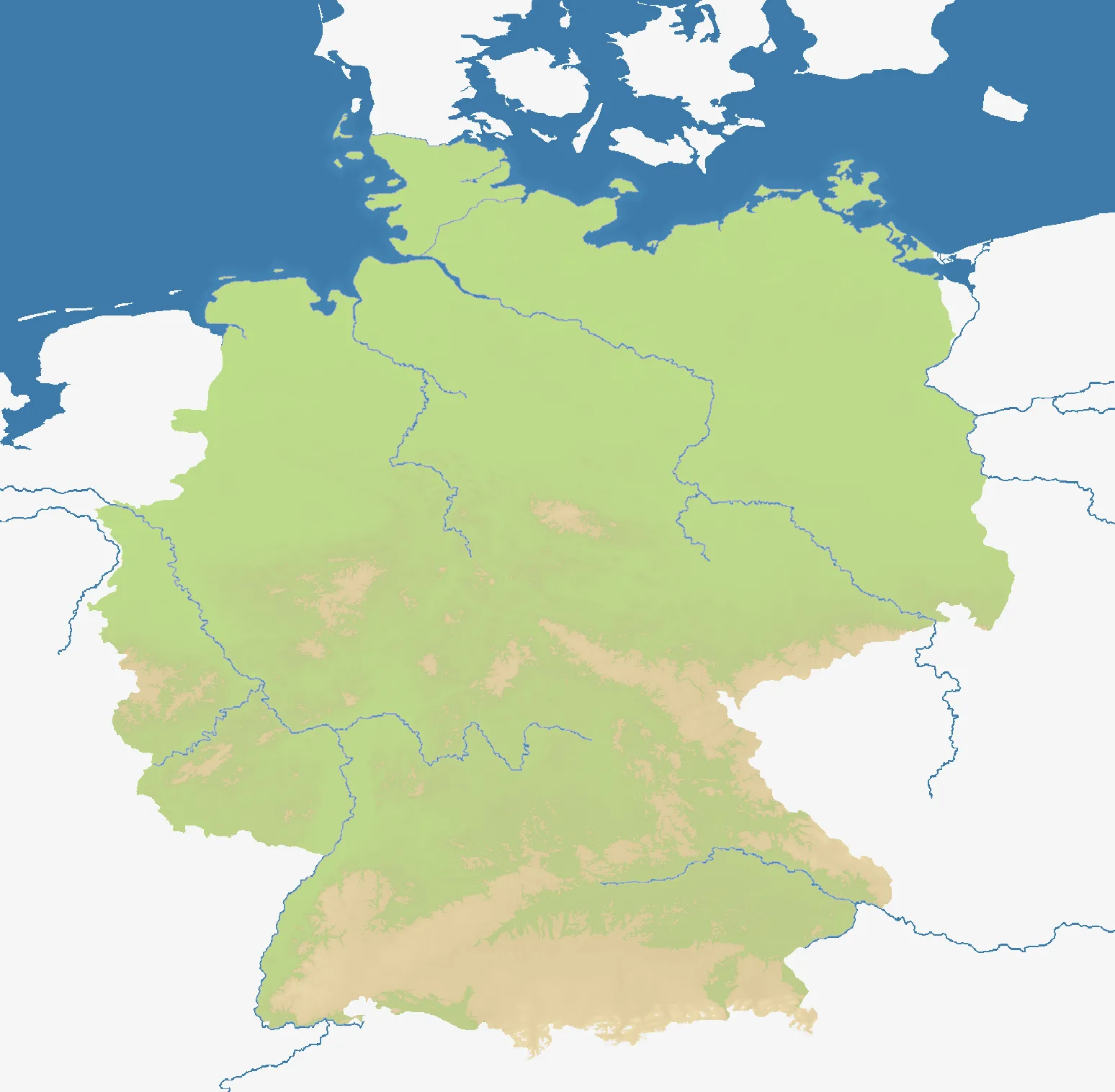
Germany maps the country’s 16 federal states across a near-square 1548×1516 field. Northern plains and coasts give way to central uplands, major river valleys and the Alpine edge in the south. The terrain is 46% land, with internal borders creating a compact national arena rather than a sprawling continental map.
The History
For centuries the region contained many states within the Holy Roman Empire. German unification created an empire in 1871; after division following the Second World War, the Federal Republic and East Germany were reunited in 1990 as today’s federal state.
The Battlefield
Central states enjoy short routes in every direction but are exposed to encirclement. The north offers more open approaches and maritime options; Bavaria and Baden-Württemberg have larger southern bases with fewer immediate angles. Rivers help organize fronts without making them permanent walls. Build a coherent regional core first, because Germany’s central geometry punishes thin salients and unattended borders.