Danish Straits
Baltic gateways between islands and peninsulas
Nations 26
The Geography
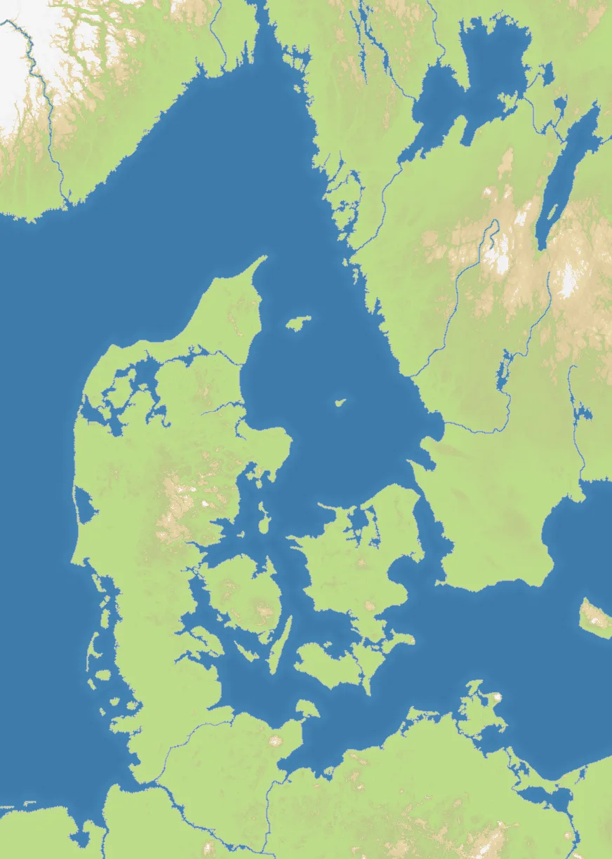
Danish Straits covers Denmark and the narrow seas linking the North Sea to the Baltic. Jutland, Zealand, Funen, southern Sweden and the German coast crowd a portrait 872×1224 frame, with islands and channels breaking up 55% land. Its 26 nations represent Scandinavian and north German regions around the gateways.
The History
These passages carried Viking traffic and later the Baltic trade. Denmark collected the Sound Dues from ships passing Helsingør between 1429 and 1857; after the 1658 Treaty of Roskilde, the eastern shore of the Øresund passed to Sweden, fixing a lasting strategic divide.
The Battlefield
The belts and sounds are the map’s decisive terrain. Jutland offers a continuous land route, while the islands trade safety for dependence on naval crossings. Zealand sits close to several fronts and can become either a bridge or a trap. Control ports on both sides of a strait, deny enemy crossings and resist the temptation to split across every island.