Clearwater Lakes
Twin impact lakes in the heart of Nunavik
Nations 13

The Geography
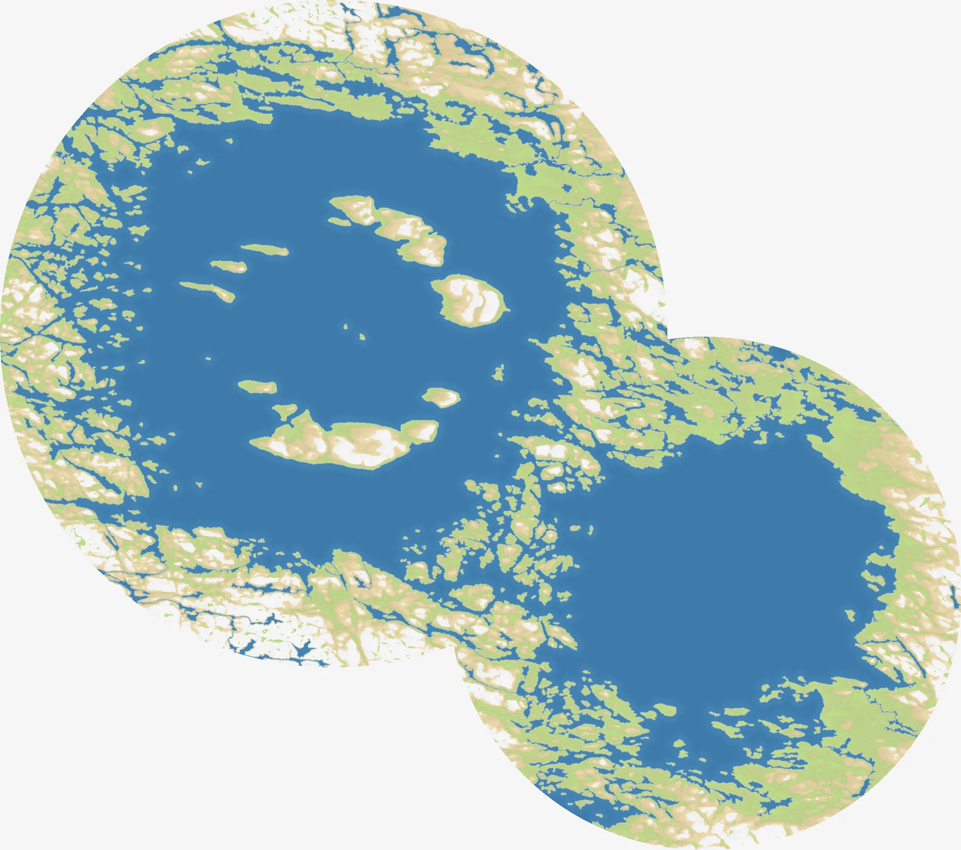
Clearwater Lakes recreates the paired circular lakes of northern Québec, on the Canadian Shield near Hudson Bay. The two great basins dominate the 1872×1656 frame: a broad western lake and a second lake to the southeast, linked by a narrow land bridge and surrounded by a broken ring of rocky shoreline. Islands and peninsulas interrupt the water rather than leaving a simple coast.
The real Clearwater Lakes are impact structures, shaped by ancient collisions and later filled with clear freshwater. In the game, that history becomes a distinctive battlefield: the outer rim offers room to spread, while the inner shores and the connecting neck concentrate the important routes. The map’s 13 starting nations are scattered across this unusual lake country, with names such as Atkinson Island, Kamiskutanikaw Island, Lake Donat and Baie Crafton anchoring the overlay.
The History
Ancient impacts — Two rings in the Canadian Shield
The Clearwater Lakes are a rare pair of large impact structures. Asteroid impacts excavated their circular basins in the ancient rock of northern Québec; erosion and the passage of geological time softened the craters, but their ring shapes remain unmistakable from above.
Nunavik — A northern homeland
The lakes lie in Nunavik, the Inuit region of northern Québec. The map’s toponyms and Nunavik flags reflect a landscape understood through northern communities, travel routes and freshwater country rather than through a conventional grid of cities and roads.
2013 — Tursujuq National Park
Tursujuq National Park was established in 2013 to protect a vast area around the Hudson Bay coast, including the Clearwater Lakes landscape. Its presence in the map’s northern overlay is a reminder that this is a protected wilderness as well as a strategic arena.
The Battlefield
Terrain Overview
Clearwater Lakes is a battle between two circles. The outer shore is the broadest expansion route, but the inner lake rims create repeated pinch points where a small force can hold a crossing or peninsula. The central islands are valuable only when they can be supplied; otherwise, the lakes turn them into isolated commitments.
Best Spawns
- Outer western rim — room to build a territory before the main routes around the lake converge
- The connecting neck — immediate influence over movement between the two basins, with high pressure from every direction
- Eastern and southeastern shore — access to the second lake’s ring of approaches and several routes toward the map edge
Avoid
- Deep inner-island starts — defensible on paper, but easy to surround if the outer rim is already contested
- Exposed lake crossings — short routes can become killing grounds when both shores are occupied
Strategic Insights
Do not treat the two lakes as separate maps. The land bridge between them is the tempo switch: hold it to keep the theaters connected, or bypass it deliberately and force an opponent to defend two rings at once. Early expansion should secure a continuous shore and a retreat path before reaching for the islands. Once the perimeter is stable, the player who controls the crossings can choose where the next front appears.
Fun Facts
- Clearwater Lakes is based on a rare pair of terrestrial impact structures rather than an ordinary lake system.
- The map’s 13 starting names include islands, individual lakes, a bay and Tursujuq National Park, mirroring the variety of northern landmarks.
- Its two dominant circular basins make Clearwater Lakes one of OpenFront’s most visually distinctive regional battlefields.