Caribbean
An ocean of islands and invasion routes
Nations 34











The Geography
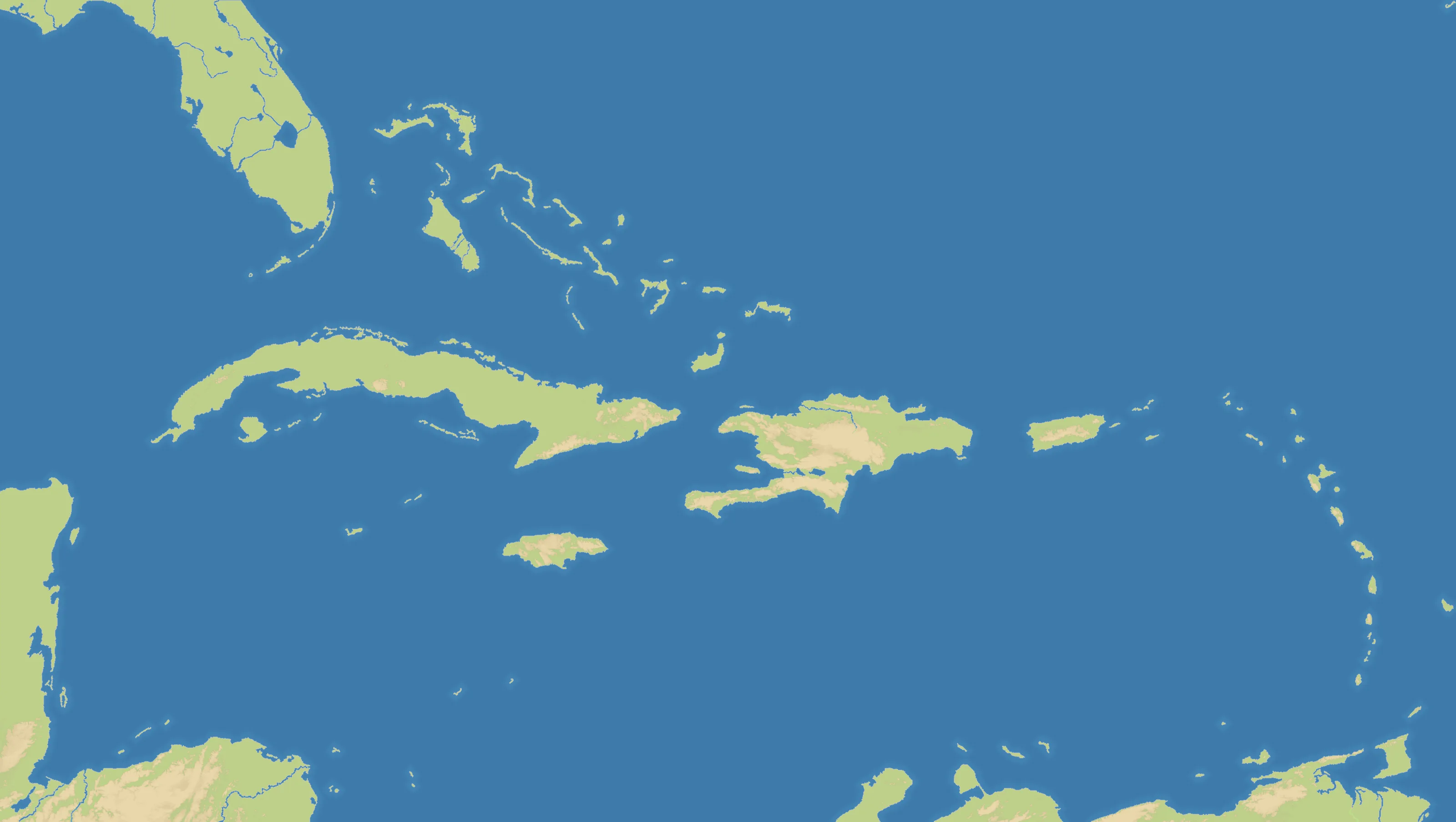
Caribbean stretches from Florida and the Yucatán to the Lesser Antilles and the northern coast of South America. Across its wide 3200×1808 frame, Cuba, Hispaniola, Puerto Rico and dozens of smaller islands form a long arc through open water. Land accounts for just 10% of the map, while 34 nations crowd its coasts and archipelagos.
The History
Indigenous Caribbean societies were transformed after European arrival in 1492. Spanish, British, French and Dutch empires then competed for islands and plantation wealth built on enslaved labour; revolutions and independence movements, beginning spectacularly in Haiti, reshaped the region.
The Battlefield
This is one of OpenFront’s most naval battlefields. Large islands offer the safest early economies, but no position remains isolated once fleets appear. The Antillean chain works as a series of stepping stones, and control of Cuba or Hispaniola opens several attack directions. Expand selectively, defend ports and avoid scattering forces across too many tiny islands.