Baltics
A sea of islands between Nordic and eastern Europe
Nations 35











The Geography
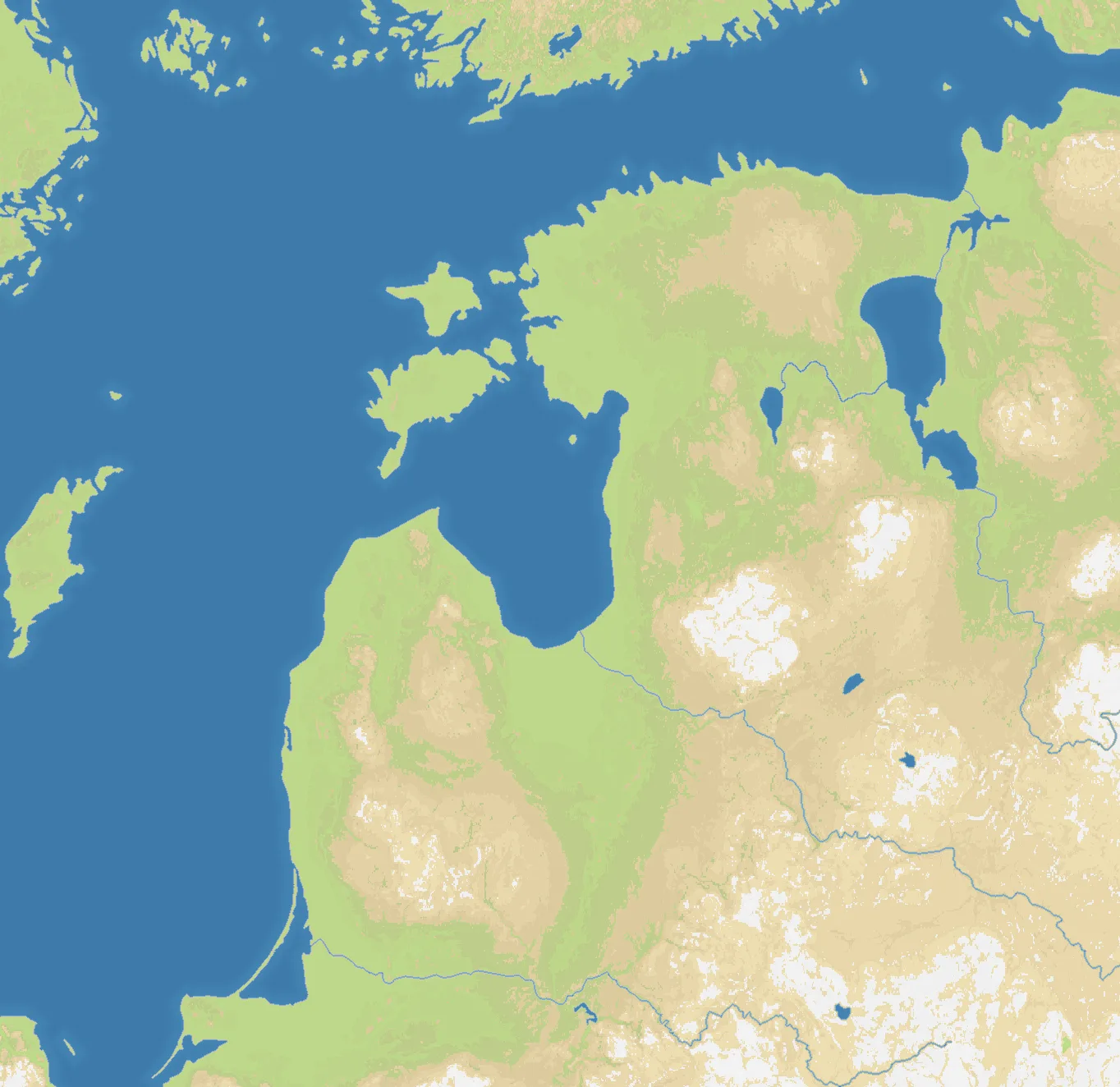
The Baltics map follows the eastern Baltic Sea from Stockholm and Åland to Helsinki, Saint Petersburg and the Gulf of Finland, then south through Estonia, Latvia and Lithuania to Kaliningrad and Gdańsk. The Baltic Sea is the map’s defining space: its gulfs, islands and peninsulas break up the coastline while leaving several routes between the Nordic, Baltic and eastern European shores.
The main starts place the political and geographic centres of the region in the same theatre. Tallinn, Riga and Vilnius sit along the Baltic states’ north–south spine; Stockholm, Helsinki and Saint Petersburg anchor the northern approaches; and Kaliningrad, Gdańsk and Maladzyechna open the southern and inland edges. Saaremaa, Hiiumaa, Gotland and Åland add island positions that can turn a crossing into a defensive line.
The History
The Baltic Sea was a commercial highway during the medieval period. The Hanseatic League connected ports such as Tallinn, Riga and Gdańsk to a wider network of northern European trade, while the eastern Baltic became a meeting ground for German, Scandinavian, Slavic and Finnic peoples.
Swedish and Polish–Lithuanian power competed for influence around the sea before Russia expanded toward the Baltic coast. The region was repeatedly reshaped by imperial borders, and Estonia, Latvia and Lithuania regained independence after the collapse of the Russian Empire in 1918. The twentieth century brought renewed occupation and upheaval before the three Baltic states restored independence in 1991.
The Battlefield
Terrain Overview
The battlefield is a ring of coastal fronts around a central sea. The Gulf of Finland narrows the northern theatre, the Gulf of Riga creates a second interior basin, and the Baltic islands divide approaches without closing them completely. Land corridors through Estonia, Latvia and Lithuania connect the north to the southern edge, while the Russian and Belarusian starts create pressure from the east.
Best Spawns
- Riga and Ogre — a central Baltic position with access to both the Gulf of Riga and the inland route toward Lithuania
- Tallinn and Helsinki — strong northern staging points with island and gulf crossings to contest
- Vilnius and Kaunas — a southern inland base with several routes toward Latvia, Belarus and the coast
- Saaremaa, Hiiumaa and Gotland — exposed island positions that can control nearby crossings when supported
Avoid
- Unscreened island starts — a fleet or neighbour can turn an isolated island into a trap
- The open central coast — centrality brings options, but also exposes every reinforcement route to several directions
- A single northern crossing — concentrating in the Gulf of Finland can leave the southern theatre undefended
Strategic Insights
The Baltics rewards a player who treats the sea as a network rather than a boundary. Secure a connected coastal base first, then use islands and gulf entrances to shorten the next advance. A northern power that ignores Riga and the Baltic states can be cut off from the south; a southern power that neglects Tallinn or Helsinki may find its northern flank opened by a single crossing. The strongest position usually links two shores before committing to a long inland push.
Fun Facts
- The map brings together Nordic, Baltic, Russian, Belarusian and Polish approaches in one continuous theatre.
- Åland, Saaremaa, Hiiumaa and Gotland make the Baltic islands part of the strategic geography rather than background scenery.
- Tallinn, Riga and Gdańsk were all important ports in the medieval trade networks around the Baltic Sea.