Balkhash
A divided lake at the heart of the Kazakh steppe
Nations 26

The Geography
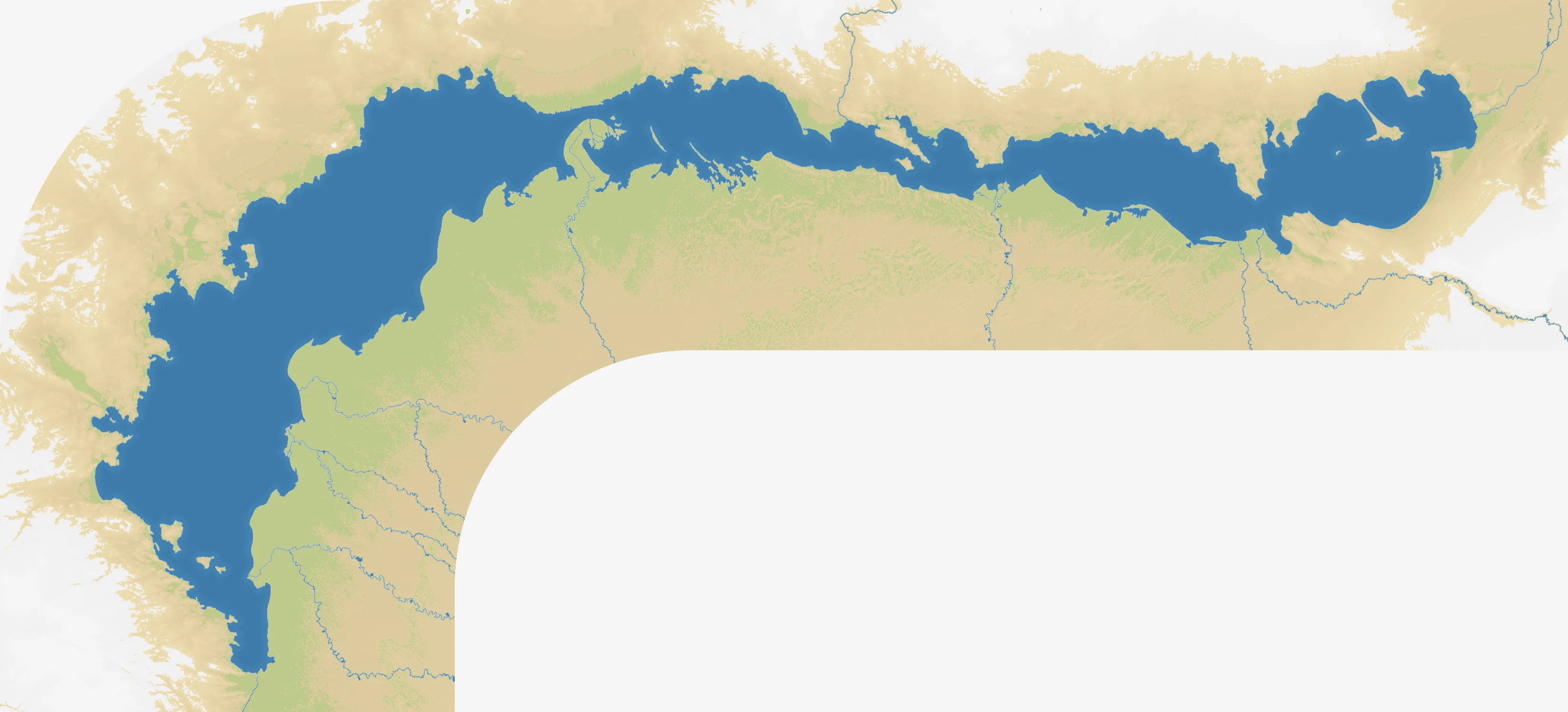
Lake Balkhash stretches across southeastern Kazakhstan, a long inland lake set between open steppe, desert and the mountain country of the east. The map presents that wide basin at 3300×1500, with the lake forming its central landmark and the surrounding approaches spreading far beyond the shoreline. Its unusual western and eastern basins are joined by the narrow Uzynaral Strait: the western basin is largely fresh, while the eastern basin is noticeably saltier.
The Ili River enters from the southeast and supplies most of the lake’s inflow. That makes the southeastern approaches feel like more than another edge of the map: they are the route into the lake’s ecological and geographical centre. The northern and southern shores offer long lateral routes, while the eastern end leads toward the Dzungarian Gate and the historic passages between Central Asia and China.
With 26 starting nations, Balkhash is a broad regional contest rather than a quiet lake map. The many named settlements around the shore create a dense ring of possible fronts, but the central water still separates western, southern and eastern ambitions.
The History
Medieval era — A lake on the steppe crossroads
The Balkhash basin sat within the wider network of steppe routes linking Central Asia, the Kazakh steppe and China. Control of these routes shifted among Turkic and Mongol powers, including the Chagatai and later Dzungar spheres, while the lake remained a landmark in an otherwise open landscape.
Fifteenth–eighteenth centuries — The Kazakh Khanate and its neighbours
The Kazakh Khanate consolidated much of the steppe around Balkhash, while rival powers competed for the routes east and south of the lake. The basin’s position made it a meeting ground between pastoral territories, oasis states and the mountain corridors toward Xinjiang.
Eighteenth–nineteenth centuries — Imperial expansion
Russian imperial expansion reached the region through forts, settlements and administrative influence across the Kazakh steppe. The lake became part of a larger frontier linking Siberia, Semirechye and the Central Asian khanates.
Twentieth century — Industry and a changing water balance
Soviet-era irrigation, mining and industrial development reshaped the Balkhash basin. Diversion of water from the Ili and pollution around the lake raised lasting concerns about its level, salinity and ecological health—issues that continue to shape the region’s future.
The Battlefield
Terrain Overview
Balkhash divides the battlefield without turning it into two separate maps. The western basin and the southern shore provide the most natural central theatre, while the Ili delta and eastern approaches reward players who can protect a long, exposed supply line. The northern shore is a useful lateral route, but it can become a long commitment if the centre is lost.
Best Spawns
- Southwestern shore — a strong launch point for contesting the lake’s central approaches and connecting with the western shore
- Ili delta / southeastern approaches — access to the map’s main inflow corridor and routes toward the eastern basin
- Eastern shore — a wide flank with room to expand, provided the western routes do not close behind you
Avoid
- Isolated shoreline pockets — defensible at first, but costly to reinforce once both neighbouring fronts are active
- A premature push around the entire lake — spreading along both shores creates a long perimeter before you have a secure core
Strategic Insights
Treat the lake as a divider and a compass. Early expansion should usually secure one shore and the nearest cross-lake approaches before reaching for the opposite basin. The Uzynaral bottleneck and the Ili-side routes are natural points of tension, but neither is valuable if the surrounding land is left open to a counterattack. Balkhash rewards a compact first front, then a deliberate turn around the water.
Fun Facts
- Balkhash is unusual among large lakes because its western and eastern basins differ so sharply in salinity
- The Ili River supplies most of the lake’s inflow, making the southeastern side central to Balkhash’s environmental story
- The map’s 26 named starting nations turn one inland lake into a crowded contest for the steppe around it