Balkans
Mountains, peninsulas and crowded borders
Nations 23





The Geography
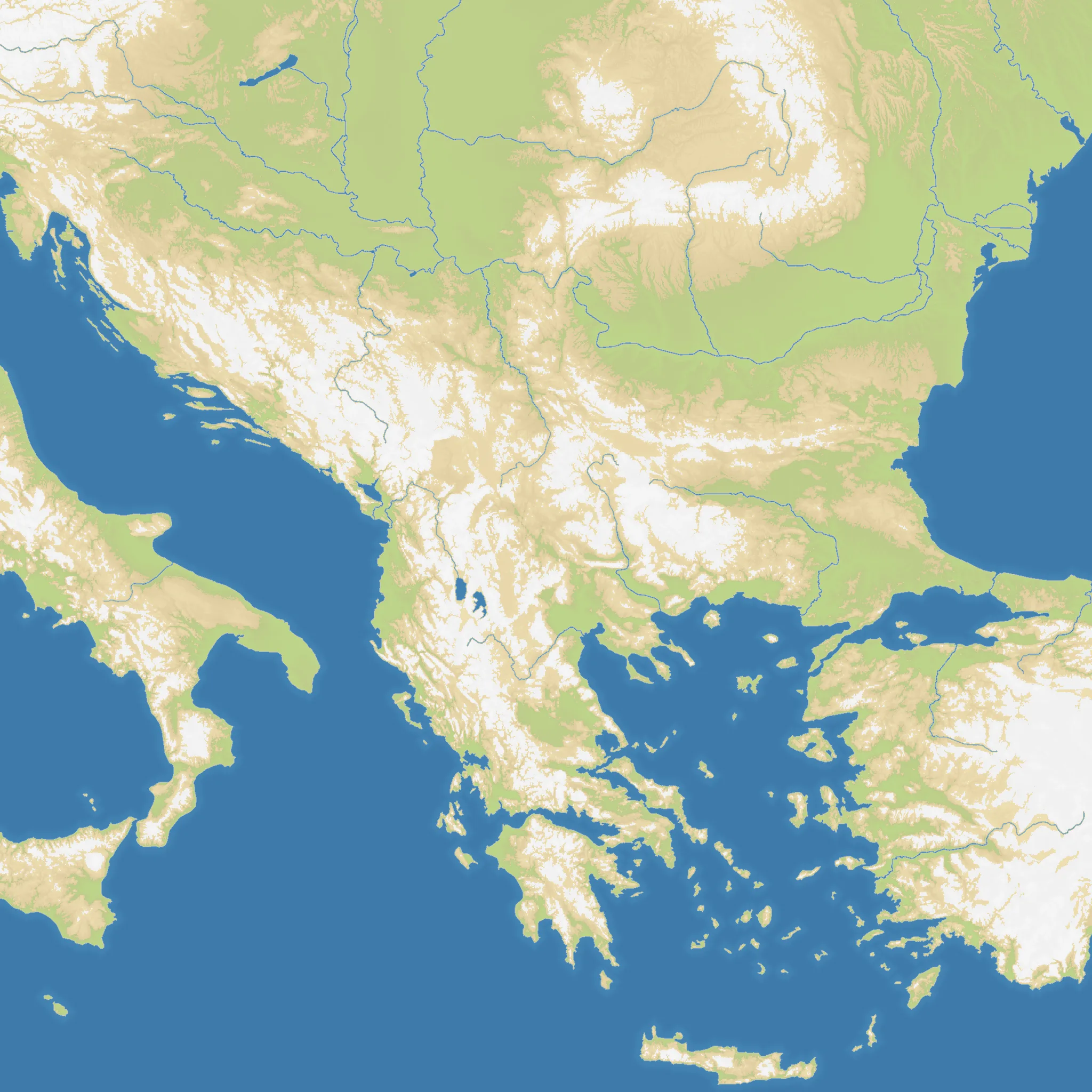
Balkans covers the meeting point of Central and Southeast Europe in a square 2048×2048 frame. The Adriatic, Aegean and Black Sea approaches cut around a land-heavy interior of mountain chains, river valleys and broken coastlines. With 59% land and 23 starting nations, the map compresses a famously intricate region into a dense battlefield.
The History
The peninsula has been a crossroads of Roman, Byzantine, Ottoman and Habsburg power. The Balkan Wars of 1912–1913 accelerated the Ottoman retreat from Europe, while the breakup of Yugoslavia in the 1990s created several of the modern borders represented here.
The Battlefield
The central inland states can expand quickly but face pressure from several directions. Coastal starts gain useful naval flanks, while Greece and the islands create narrow approaches that are easy to contest. Secure one defensible core before reaching across the region; overextending through the mountain corridors leaves long, exposed borders.