Yenisei
Siberia's great river cuts the wilderness
Nations 6

The Geography
The Yenisei is one of the great rivers of Eurasia, flowing north through central Siberia to the Kara Sea in the Arctic Ocean. Together with its tributaries, especially the Angara, it drains an immense basin stretching from the mountains near Mongolia deep into the taiga and tundra. Along its course lie places like Krasnoyarsk, Yeniseisk, and Dudinka — settlements that exist because a giant river can turn otherwise forbidding territory into a corridor of movement and supply.
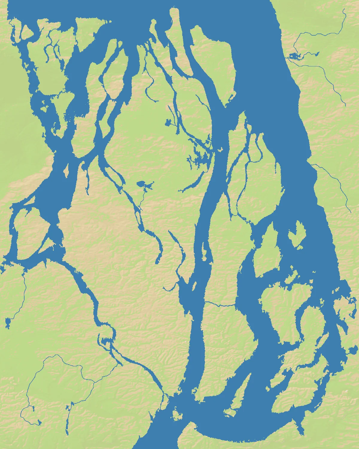
That corridor is the logic of the map. At 1200×1500, the battlefield has a pronounced north-south orientation that mirrors the real river’s flow. With 67% land and only 6 nations, Yenisei is spacious compared with many regional maps. There is enough solid ground for broad expansion, but the river and its side channels still organize the whole contest: cross too late and you lose initiative, cross too often and you overexpose yourself.
Siberia’s scale is part of the appeal. This is not a cramped delta or urban estuary. It is a map of long distances, sparse nodes, and a single dominating spine. The river does not just divide territory; it tells players where the campaign is likely to happen.
The History
1580s–1600s — Russian Advance into Siberia
After the fall of the Khanate of Sibir, Russian explorers, traders, and Cossacks pushed eastward across the forest zone. Rivers like the Yenisei became the practical highways of conquest, linking forts, fur posts, and new settlements across enormous distances.
1822 — Yenisei Governorate and Imperial Administration
As the Russian Empire consolidated control, central Siberia became more formally administered and integrated. River transport remained essential: official power in Siberia depended on controlling the few reliable movement corridors available in such a vast landscape.
1890s–1910s — The Railway Meets the River World
The Trans-Siberian Railway passed south of much of the Yenisei basin, but its arrival transformed the wider region’s economy and settlement patterns. Rail and river together created layered logistics, with the Yenisei still serving as a major artery into the deep interior.
1960s–1980s — Dams and Industrial Siberia
Soviet hydroelectric projects, especially around the Angara-Yenisei system and Krasnoyarsk, turned the basin into a major industrial-energy zone. In the modern era, the river is not just a route through wilderness; it is part of Russia’s heavy infrastructural core and its Arctic strategy.
The Battlefield
Terrain Overview
Yenisei is a river corridor map in the purest sense. Control of the banks matters, but so does control of the crossing rhythm. The central channel creates a long operational line, while the surrounding land offers enough room that flank maneuvers are possible if you can sustain them. Northern positions tend to be remote and defensive; southern positions are often richer and more connected.
Because there are only six nations, the map develops in large shapes rather than micro-fronts. A strong start can absorb a lot of land before meeting serious resistance, which makes early direction-setting critical. Expand along the river too narrowly and you become predictable. Expand too broadly into the hinterland and you may lose the initiative at the crossings.
Best Spawns
- Middle Yenisei near major bends — central control over the river spine and flexible response options.
- Southern basin approaches — more productive land and faster access to the rest of the map.
- West-bank interior positions — room to build while keeping the river as a defensive anchor.
Avoid
- Far northern Arctic edge — safe for a moment, but too distant from the map’s decisive central fights.
- Thin east-bank stretches with few crossings — awkward reinforcement and easy to isolate.
Strategic Insights
The best Yenisei players use the river as both shield and ladder. You want one bank to serve as your production core and selected crossing points to serve as launchpads. Holding every crossing is unnecessary; holding the right crossings at the right time is what wins.
This map rewards patience more than many regional boards. With 67% land and few nations, there is time to shape your empire before the decisive collision. But once one player controls the middle river and a secure southern economy, Siberia starts to feel surprisingly small.
Fun Facts
- The Yenisei-Angara system is often ranked among the largest river systems in the world by discharge to the Arctic Ocean.
- Krasnoyarsk Dam created one of Russia’s major hydroelectric reservoirs, symbolizing how Soviet planning tried to industrialize Siberia at continental scale.
- The Yenisei roughly marks a traditional geographic division between western and eastern Siberia in many regional definitions.