South America
Andes wall, Amazon sea of green
Nations 24


The Geography
South America is a continent organized by two colossal systems. Along the entire western edge runs the Andes, the longest continental mountain chain on Earth, forming a narrow but decisive spine from Venezuela to Tierra del Fuego. East of that wall lies the Amazon Basin, a lowland watershed so vast that it feels almost oceanic in scale. Further south, the continent opens into the grasslands of the Pampas and the cold, wind-scoured reaches of Patagonia.
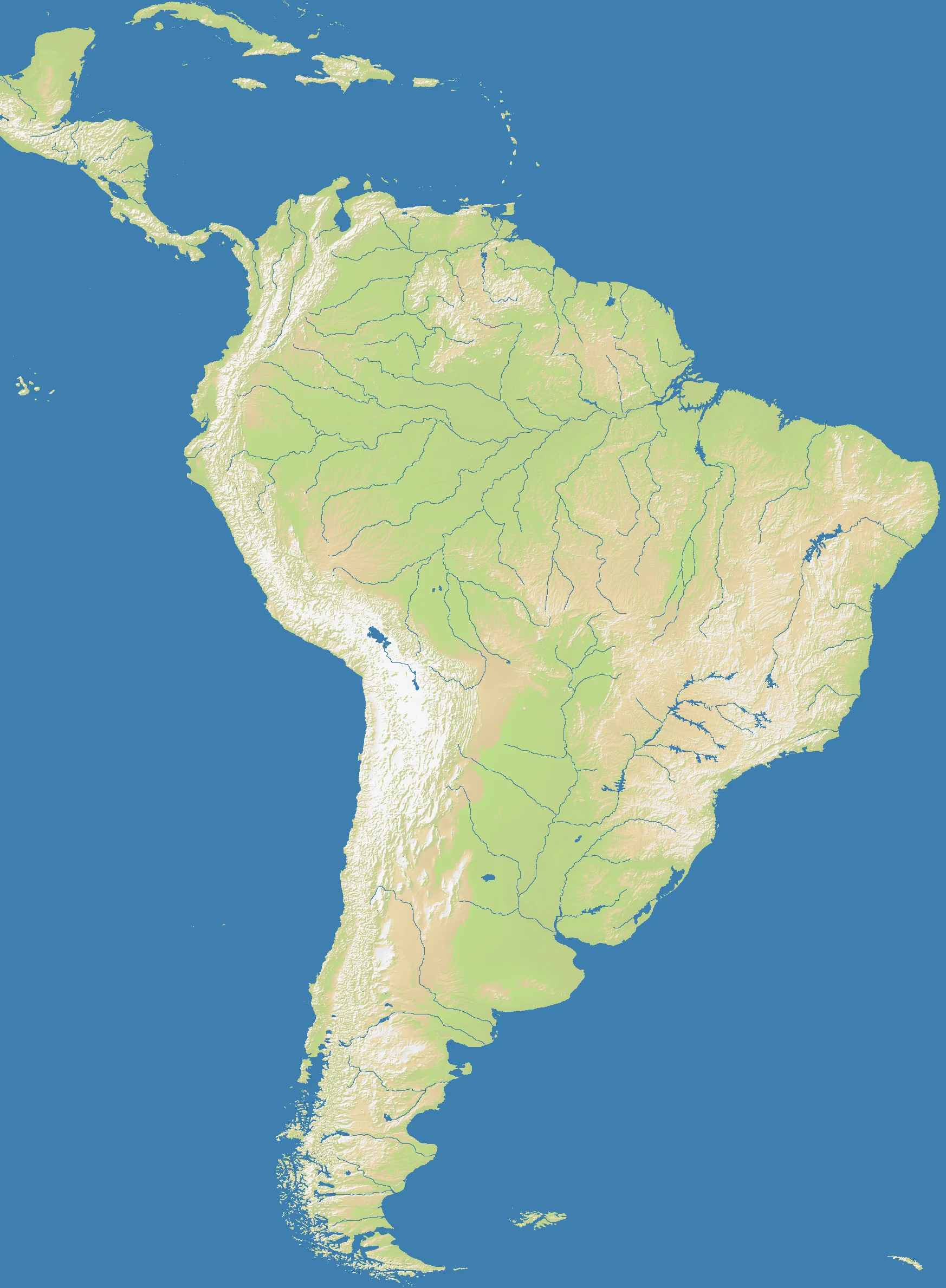
The OpenFront map emphasizes that vertical drama. At 1744×2376, South America is a tall portrait map, so distance north-to-south becomes a strategic problem in its own right. With only 34% land, the continent is heavily broken by coastlines, gulfs, estuaries, and waterways; the land that does exist is stretched into long corridors and separated theaters. Twenty-four nations means the map is busy, but never uniformly crowded.
This is a continent of edges. The Pacific coast is compressed beneath the Andes, the Atlantic side is broader and more open, and the Amazon interior acts less like a highway than a huge difficult middle. The player who sees South America as one unified landmass usually loses to the one who understands it as several connected campaigns.
The History
1400s — The Inca Highland Empire
Before European conquest, the Inca ruled a vast Andean state linked by mountain roads, storehouses, and administrative centers. Their empire demonstrates the central truth of western South America: difficult terrain does not prevent power if routes through it are controlled.
1494 — Iberian Division of a Continent
The Treaty of Tordesillas divided newly claimed lands between Spain and Portugal, helping produce the enduring split between Portuguese-speaking Brazil and Spanish-speaking much of the rest of the continent. Colonial rule then tied ports, mines, and river systems into Atlantic imperial networks.
1810s–1820s — Wars of Independence
Simón Bolívar, José de San Martín, and other independence leaders shattered Spanish control across northern and southern South America. These campaigns crossed mountains, plains, and jungles, proving that continental-scale warfare here has always been shaped by terrain.
1960s–1980s — Cold War Fronts
South America became a theater of coups, insurgencies, military dictatorships, and superpower influence. From the Southern Cone to the Andes and Amazonian frontiers, politics and geography combined to make control of interior regions and strategic coasts especially significant.
The Battlefield
Terrain Overview
South America is defined by asymmetry. The Andes create a tight western lane with defensible but narrow positions. The Amazon Basin dominates the north-central interior, slowing straightforward conquest and making the river world feel like a broad zone of friction rather than easy access. The southeast — Brazil’s coast, the Río de la Plata region, and the Pampas — offers the most room for conventional expansion.
Patagonia is distant and sparse, but that distance can be an advantage if used to consolidate. The Caribbean-facing north has many maritime openings, while the Pacific side is hemmed in by mountains and sea. Because the map is so tall, timing reinforcements between north and south is a major challenge.
Best Spawns
- Southeast Brazil-Río de la Plata arc — dense expansion options, broad frontage, and strong maritime flexibility.
- Northern Atlantic coast — good access to both the Amazon edge and ocean lanes around the continent.
- Central Andes foothills — defensible terrain with leverage over the western corridor if managed carefully.
Avoid
- Deep Amazon interior — huge but awkward, with slow consolidation and too many exposed approaches.
- Far Pacific slivers — little room, difficult reinforcement, and easy to trap against the mountains.
Strategic Insights
On this map, geography chooses your style. Atlantic powers can grow wider and reposition faster; Andean powers must play narrower, sharper, and more defensively. The Amazon is not useless, but it rarely rewards a pure early rush. It is better used as a buffer, a flank, or a late-game bridge once your economy can support the distance.
Because only 34% of the map is land, coastline control is unusually valuable. Fleets can often do what mountains prevent armies from doing. The strongest empires are usually the ones that combine one stable land core — southeast, north coast, or southern cone — with the ability to threaten around the edges.
Fun Facts
- The Andes extend for roughly 7,000 km, making them the longest continental mountain range on Earth.
- The Amazon River carries more water than any other river system in the world and drains a basin larger than the European Union.
- South America’s portrait shape in OpenFront mirrors a real-world continent that spans from near the Caribbean tropics to subpolar latitudes.