North America
From Arctic tundra to tropical coast
Nations 49


The Geography
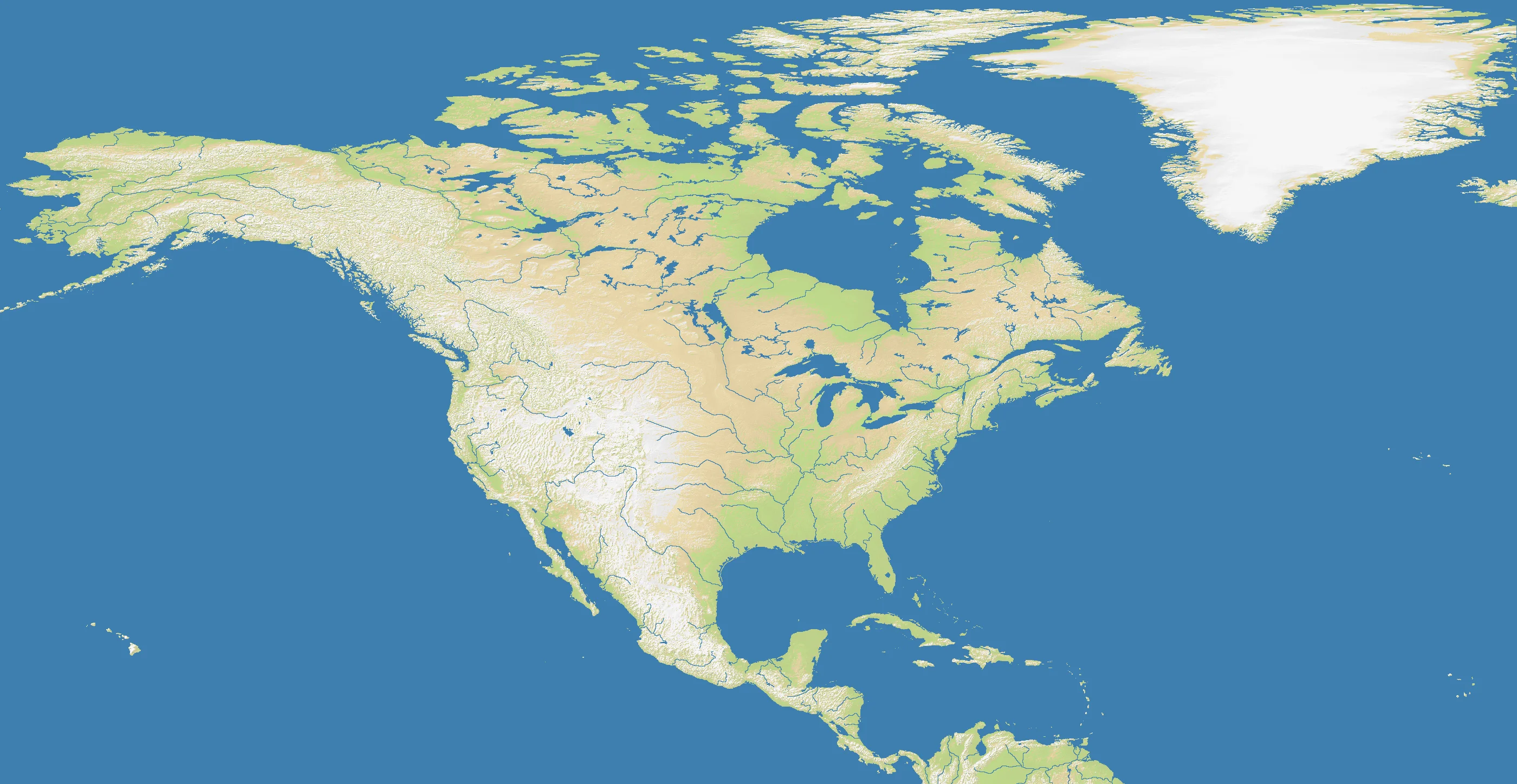
The North America map spans the continent’s full 2800×1448 extent, from the permafrost of the Arctic north to the narrow isthmus connecting Central America. The terrain captures the continent’s great geographical contrasts: the Rocky Mountain spine running the full length of the western edge, the vast interior plains (the Great Plains and Canadian Prairies), the Great Lakes cluster in the northeast, the dense river system of the Mississippi-Missouri basin, and the Atlantic coastal plain in the east.
At 30.7% land, the map skews water-heavy — the Gulf of Mexico, Caribbean, and Pacific/Atlantic coastlines all translate into significant open water. The Central American land bridge at the southern tip narrows to a crucial chokepoint, and the Gulf of St. Lawrence creates a natural barrier between Eastern Canada and the Atlantic.
The History
10,000 BCE — First Peoples
Long before European contact, the continent supported hundreds of distinct civilizations — from the mound-builders of the Mississippi Valley to the cliff-dwellers of the Southwest and the confederacies of the Northeast. Their settlement patterns often followed the same rivers and mountain gaps that define strategic terrain in the game.
1607–1776 — Colonial Competition
British, French, Spanish, and Dutch colonial powers carved competing territories out of the eastern seaboard and interior. The eventual dominance of the British colonies and their independence set the political template for the continent’s north-south division between English-speaking Canada and the United States.
1803 — The Louisiana Purchase
A single transaction doubled the size of the United States and pushed its borders to the Rocky Mountains. The subsequent westward expansion compressed the continent’s indigenous nations and drew the political geography that defines most of the spawn zones on this map.
1867 — Canadian Confederation
The creation of the Dominion of Canada unified Britain’s North American territories and established the continent’s defining northern nation. The vast Canadian shield — precambrian rock underlying much of the northern map — is some of the oldest geological material on Earth.
The Battlefield
Terrain Overview
The Rocky Mountains form a decisive west-east divide. Players spawning on the Pacific side face a natural barrier to eastward expansion; players in the interior have access to the great plains highway running north-south. The Great Lakes create a de facto border in the northeast that shapes expansion routes significantly.
Best Spawns
- Central Plains (Midwest / Great Plains) — maximum land connectivity, expansion in all four cardinal directions, no early natural barriers to worry about
- Southeast (Gulf Coast) — access to both Atlantic and Gulf sea lanes, warm southern buffer, room to grow inland
- Pacific Northwest — defensible mountain flank, coastal access, relatively low initial neighbor pressure
Avoid
- Caribbean / Gulf island positions — naval isolation is a real threat early; small land area limits early growth
- Far north (Arctic Canada) — limited expansion neighbors, slow early game, eventually outpaced by southern nations
Strategic Insights
The Central American chokepoint is one of the most strategically important positions on the map — whoever controls it blocks movement between North and South American theater if the Americas maps are played as a combined campaign. The Mississippi River corridor drives interior trade and movement. Naval presence in the Gulf of Mexico can project power onto three different coastlines simultaneously.
Fun Facts
- At 2800×1448, North America is the widest map in the game
- The 49 nations include both massive territorial nations and tiny Caribbean island states — the disparity in starting position quality is among the largest of any map
- The Great Lakes region is one of only a handful of areas in the game where inland freshwater terrain creates navigable chokepoints