MENA
Empires rise where deserts permit movement
Nations 35


The Geography
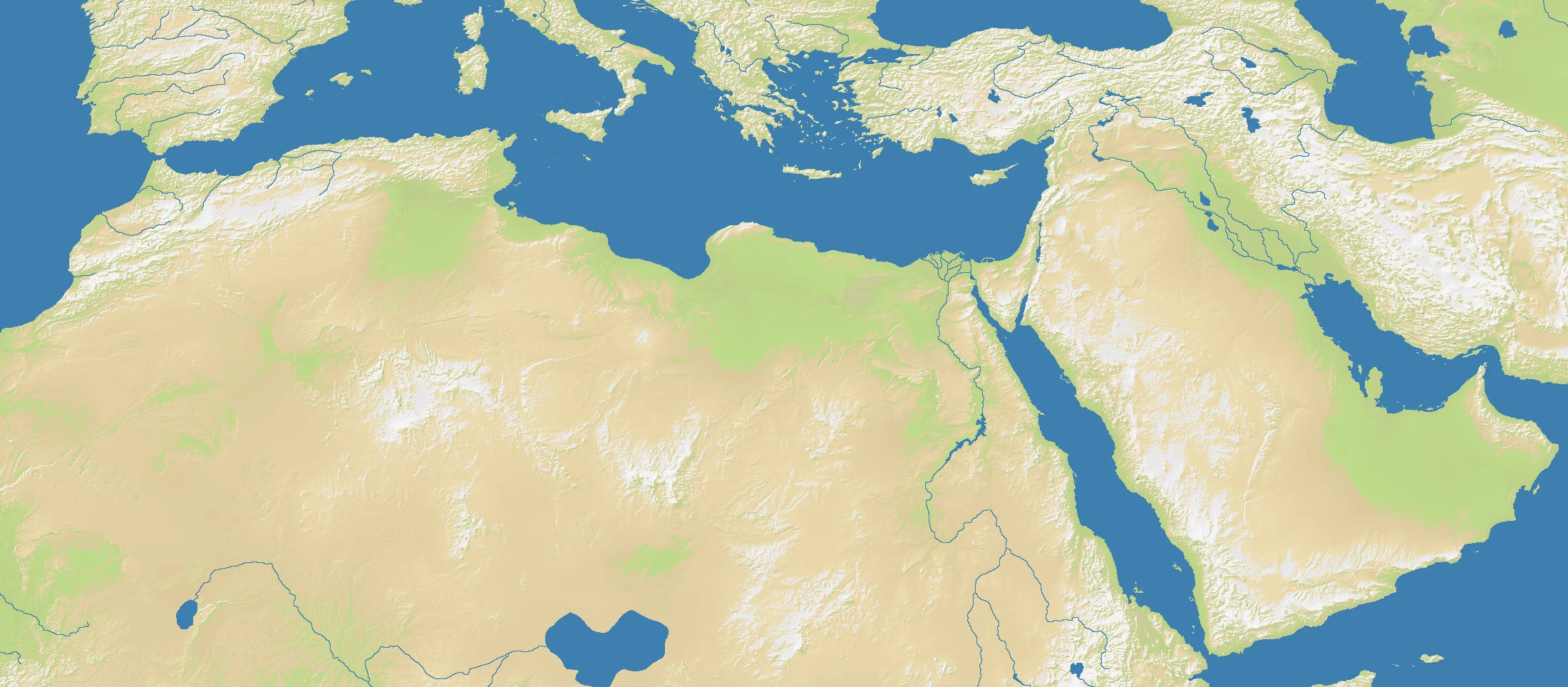
MENA spans the Middle East and North Africa, a region where the most decisive terrain is often not what exists, but what does not. The OpenFront map is wide and shallow at 2200×964, with 76% land and 24% water. Yet that land is far from uniformly useful: the Sahara, Arabian Desert, Syrian steppe, and other arid zones dominate huge portions of the board, funneling movement toward coasts, river valleys, mountain margins, and oasis corridors.
That is why the map’s key anchors are so familiar to world history. The Nile slices through Egypt as a linear civilization. Mesopotamia opens along the Tigris and Euphrates. The Levant forms a bridge between Africa and Asia. Anatolia and Iran stand as higher, harder inland masses, while the Mediterranean, Red Sea, Persian Gulf, and Arabian Sea frame the region with maritime options.
In strategic terms, MENA is about chokepoints on a continental scale. The Suez corridor, the Levantine coast, the Gulf, and the river basins all matter because the surrounding deserts make alternative routes slow, expensive, or impossible.
The History
c. 3500 BCE — Cradles of Civilization
Cities, writing, and states emerged in Mesopotamia and the Nile Valley earlier than almost anywhere else on Earth. In a harsh climatic zone, reliable rivers created dense centers of power that could tax agriculture, organize labor, and sustain armies.
7th–10th Centuries — Islamic Expansion and the Golden Age
Arab-Muslim conquests unified vast stretches of the region under new political and religious structures. Cities such as Baghdad, Damascus, Cairo, and Córdoba became centers of trade, law, science, and translation connecting the Mediterranean, Indian Ocean, and Silk Road worlds.
1517–1918 — Ottoman and Imperial Rule
The Ottoman Empire dominated much of the Middle East and North Africa for centuries, though Persia and Morocco remained outside its full grasp. Its eventual decline opened the way for European intervention, culminating in wartime partition schemes like Sykes-Picot that redrew the political map.
20th–21st Centuries — Oil, States, and Upheaval
Petroleum transformed the strategic value of the Gulf and wider region, drawing global powers deeply into local politics. More recently, revolutions and protests during the Arab Spring showed how modern state systems built on old imperial lines remain unstable.
The Battlefield
Terrain Overview
MENA is a corridor map disguised as open space. It looks broad, but deserts sharply narrow viable movement into rivers, littorals, mountain fringes, and a handful of indispensable passages.
Best Spawns
- Nile corridor — dense, fertile, and one of the clearest growth spines on the map
- Levant crossroads — access between Africa, Anatolia, Arabia, and Mesopotamia makes this a natural hinge region
- Mesopotamian core — strong internal continuity and direct relevance to multiple theaters
Avoid
- Deep desert interiors — too much land that does too little, with long lines and poor flexibility
- Peripheral corners beyond the main corridors — often defensible, but strategically irrelevant if the center consolidates elsewhere
Strategic Insights
The instinct to spread everywhere is a trap on MENA. The strongest positions sit on routes that other players must use, because desert dominance means little unless it translates into command of rivers, coasts, or passes.
Fun Facts
- The word “Sahara” comes from the Arabic ṣaḥrāʾ, simply meaning “desert”
- Suez links the Mediterranean and Red Sea, making Egypt one of the world’s enduring transit chokepoints
- The Fertile Crescent arcs through otherwise arid lands, which is why so much early state formation happened there