Mediterranean
Three continents around one historic sea
Nations 38


The Geography
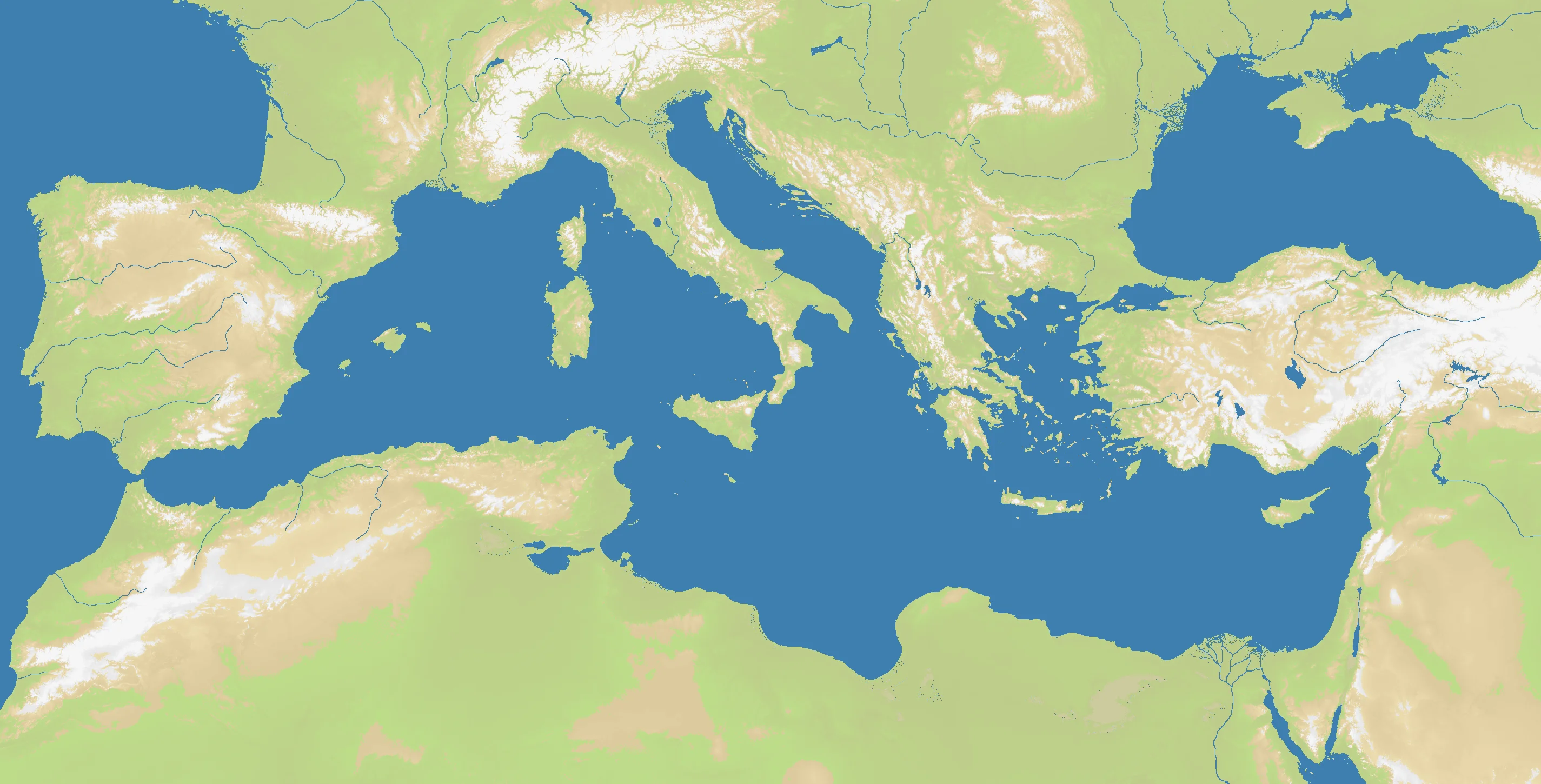
The Mediterranean is less a sea than a civilizational machine. Bounded by Europe to the north, Africa to the south, and Asia to the east, it compresses three continents into a relatively enclosed basin linked to the Atlantic only through the Strait of Gibraltar. The OpenFront Mediterranean map is an enormous regional board at 2848×1448, with 64% land and 36% water. Even with that strong land share, the sea at the center organizes everything around it.
Its subregions each have their own personality: the western basin between Iberia, North Africa, and Italy; the central basin around Sicily and Tunisia; and the eastern basin of Greece, Anatolia, the Levant, and Egypt. Peninsulas, islands, and chokepoints are everywhere — Gibraltar, Sicily, the Adriatic entrance, the Aegean maze, the Nile delta. This is why the Mediterranean has always favored powers able to combine land depth with maritime reach.
No other regional map in the atlas has as many nations as Mediterranean’s 38. That scale is historically appropriate. This sea has never belonged to one people for long; it is a crowded arena where geography encourages trade, colonization, piracy, and imperial overstretch all at once.
The History
c. 800–500 BCE — Phoenicians and Greeks Spread Across the Sea
Phoenician merchants and Greek colonists stitched the Mediterranean into a network of ports, colonies, and exchange zones. The basin became a highway for alphabets, art styles, gods, grain, and war.
2nd Century BCE — Rome’s Mare Nostrum
After defeating Carthage and dominating the Hellenistic world, Rome turned the Mediterranean into Mare Nostrum — “our sea.” Control of the basin allowed the empire to move armies, taxes, grain, and ideas with extraordinary efficiency.
1453–1571 — Ottoman and Habsburg Contest
The fall of Constantinople and the rise of Ottoman naval power transformed the eastern Mediterranean, while Habsburg Spain and Venice fought to contain it. For centuries the sea was the fault line between rival empires, faiths, and trade systems.
1940–1943 — World War II in the Mediterranean
North Africa, Malta, Crete, Sicily, and the convoy routes between them turned the Mediterranean into one of the key theaters of the Second World War. Whoever controlled islands and shipping lanes could sustain or strangle entire campaigns.
The Battlefield
Terrain Overview
Mediterranean is a macro-strategy map. The sea unites the map, but the surrounding landmasses are large enough that players can build continental power bases before clashing across water.
Best Spawns
- Central Italy/Sicily corridor — perhaps the strongest pivot point on the map, with access to both eastern and western basins
- Aegean-Anatolian zone — dense with islands, crossings, and opportunities for tactical sea control
- Levant or Nile approaches — rich historical crossroads with multiple expansion vectors by land and sea
Avoid
- Extreme western or eastern corners — safer initially, but slow to affect the basin-wide balance of power
- Small isolated islands without mainland leverage — glamorous, but often too dependent on perfect naval execution
Strategic Insights
Mediterranean rewards layered strategy. Short-term players fight for islands; strong players fight for chokepoints; the best players understand that the real prize is linking a secure continental base to a fleet that can intervene anywhere from Gibraltar to the Levant.
Fun Facts
- Mediterranean takes its name from the Latin mediterraneus, meaning “in the middle of lands”
- It has the highest nation count of any regional map in OpenFront Atlas at 38
- The sea level nearly refilled from the Atlantic in a catastrophic flood event after the ancient Messinian salinity crisis