Manicouagan
A crater lake in the Quebec wilds
Nations 11

The Geography
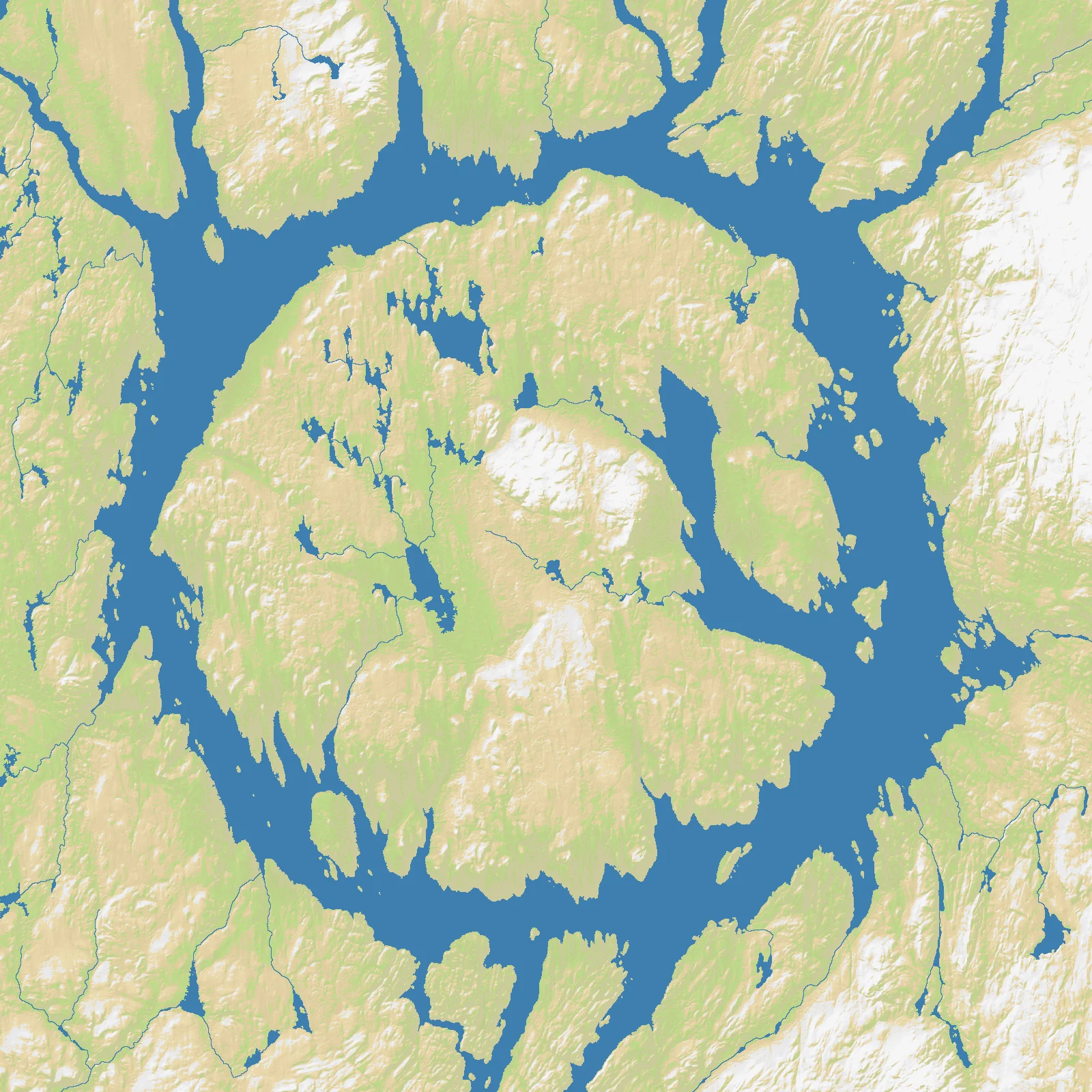
Manicouagan is one of the strangest landscapes in North America. The map is centered on the Réservoir Manicouagan in central Quebec, a ring-shaped lake occupying the eroded remains of a giant impact crater about 100 kilometers across. On the OpenFront map (1600×1600), land makes up 78% of the terrain and water only 22%, so despite the spectacular central reservoir this is fundamentally a land-dominant wilderness battlefield.
The crater was created roughly 215 million years ago, but the modern shape is also a product of hydroelectric engineering. The reservoir was enlarged by the Daniel-Johnson Dam, turning the ancient structure into a vast inland water barrier encircling René-Levasseur Island at its center. Around it stretches the Canadian Shield: hard rock, boreal forest, rivers, and sparse infrastructure.
This is remote country, historically part of Innu territory and still defined more by geology, hydroelectric corridors, and forest than by dense settlement. Geography here is not urban or agricultural; it is raw terrain, broken by water and distance.
The History
215 Million Years Ago — The Impact
A massive meteorite slammed into what is now Quebec, leaving one of Earth’s largest visible impact structures. The ring it carved survived deep time well enough that satellites can still pick it out clearly today.
Indigenous Era — Innu Homeland
Long before dams and modern maps, the wider Manicouagan region was part of the territory used by Innu communities for hunting, fishing, and seasonal movement. The landscape’s rivers and lakes were routes of travel in a place where roads came very late.
1960s — Hydroelectric Transformation
Quebec’s hydroelectric expansion reshaped the region, especially with the construction of the Daniel-Johnson Dam on the Manicouagan River. The reservoir became both an engineering symbol and a major energy asset for the province.
Modern Era — Science and Wilderness
Today Manicouagan is known simultaneously as a geological wonder, a hydroelectric zone, and a remote recreation landscape. Its fame comes less from cities or armies than from the rarity of seeing a planetary scar this clearly on the surface.
The Battlefield
Terrain Overview
Manicouagan is a land map disrupted by a giant circular water obstacle. The reservoir splits movement, creates long detours, and makes the central island both tempting and awkward.
Best Spawns
- Southern approaches — better connectivity and easier access to routes around the reservoir
- Western shore arcs — strong balance between defensibility and outward expansion
- Near central crossings — risky, but powerful if you can dominate movement around the ring early
Avoid
- Far northern edge — remote, slow to develop, and easy to fall behind economically
- Central island without secure crossings — looks dominant, but can become isolated surprisingly fast
Strategic Insights
The reservoir defines everything. You cannot treat the map like open land because the ring lake repeatedly interrupts advance lines; the strongest players use the shoreline geometry to force enemies into predictable, elongated approaches.
Fun Facts
- Astronauts have called Manicouagan one of the easiest impact craters on Earth to recognize from space
- René-Levasseur Island inside the reservoir is itself larger than some small countries’ main islands
- The Daniel-Johnson Dam is one of the largest multiple-arch-and-buttress dams in the world