Lisbon
Where river, ocean, and empire met
Nations 15

The Geography
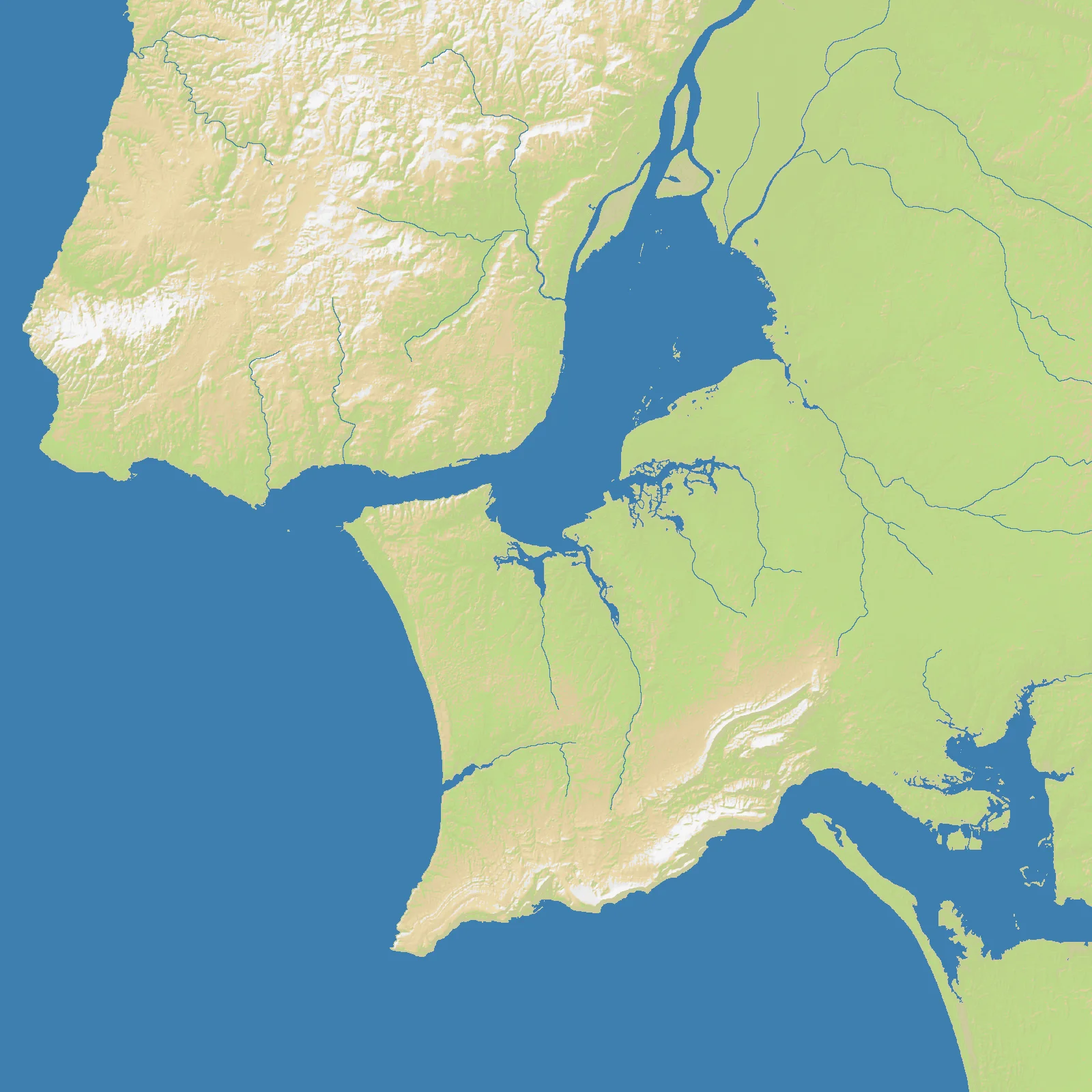
The Lisbon map centers on one of Europe’s great estuaries: the lower Tagus, where the river broadens into a wide inland sea before reaching the Atlantic. At 1600×1600 and 58% land, the map balances substantial maneuver space on shore with a dominant water feature cutting through the middle. The Setúbal Peninsula, the Lisbon shoreline, and the southwestern Portuguese coast together create a theater shaped by crossings, harbors, and estuarine bottlenecks.
Lisbon’s real strength has always come from being both protected and outward-facing. Ships can shelter upriver, yet reach the open Atlantic quickly; armies can move along the coasts or fight for the bridgeheads around the estuary. South of the Tagus, the coast opens toward Setúbal and beyond, while farther south the Algarve connects Portugal to broader Atlantic and Mediterranean routes.
Unlike purely maritime maps, Lisbon offers meaningful interior land play. But the water remains the organizing principle: the Tagus is not an obstacle at the edge of the map — it is the map.
The History
1147 — Christian Conquest of Lisbon
During the Second Crusade, Afonso Henriques and allied crusaders captured Lisbon from Muslim rule. Securing the estuary gave the emerging Portuguese kingdom a capital with both defensive depth and ocean access.
1497 — Vasco da Gama Sails East
Lisbon became the launch point for Portugal’s greatest voyages, including Vasco da Gama’s expedition to India. From this estuary, caravels and naus connected Iberia to Africa, Asia, and eventually Brazil, helping make Portugal the first global maritime empire.
1755 — The Great Lisbon Earthquake
On All Saints’ Day, an earthquake, tsunami, and fires devastated Lisbon and killed tens of thousands. The disaster reshaped the city physically, drove the Pombaline rebuilding program, and shook Enlightenment Europe’s faith in a rational and orderly world.
1807–1808 — The Court Flees Napoleon
As Napoleon invaded Portugal, the royal court fled from Lisbon to Brazil under British naval protection. Few cities illustrate the link between river harbor and imperial survival more clearly than Lisbon at this moment.
The Battlefield
Terrain Overview
Lisbon is an estuary-control map. The Tagus splits the battlefield into interacting north and south banks, and command of crossings determines whether expansion feels smooth or constantly interrupted.
Best Spawns
- Lisbon north bank — central, wealthy, and historically the most connected shoreline on the map
- Setúbal Peninsula — defensible angle with strong naval leverage into the estuary mouth
- Southwestern coast — room to grow before joining the fight for the Tagus core
Avoid
- Estuary-edge pockets without crossing control — rich on paper, but vulnerable to being pinned on one bank
- Far southern extremities — safer early, yet slow to influence the decisive center
Strategic Insights
The winning plan in Lisbon usually combines bank control with seaborne flexibility. If you own one shore but cannot threaten the other, you become predictable; if you live only on ships, a land power can lock down the estuary and starve you out.
Fun Facts
- The Tagus estuary is one of the largest natural harbors in western Europe
- Lisbon launched expeditions that reached India, Brazil, Japan, and parts of East Africa within a century
- The 1755 earthquake became a defining event in European philosophy as well as urban planning