Italia
The boot that kicks into every sea
Nations 12


The Geography
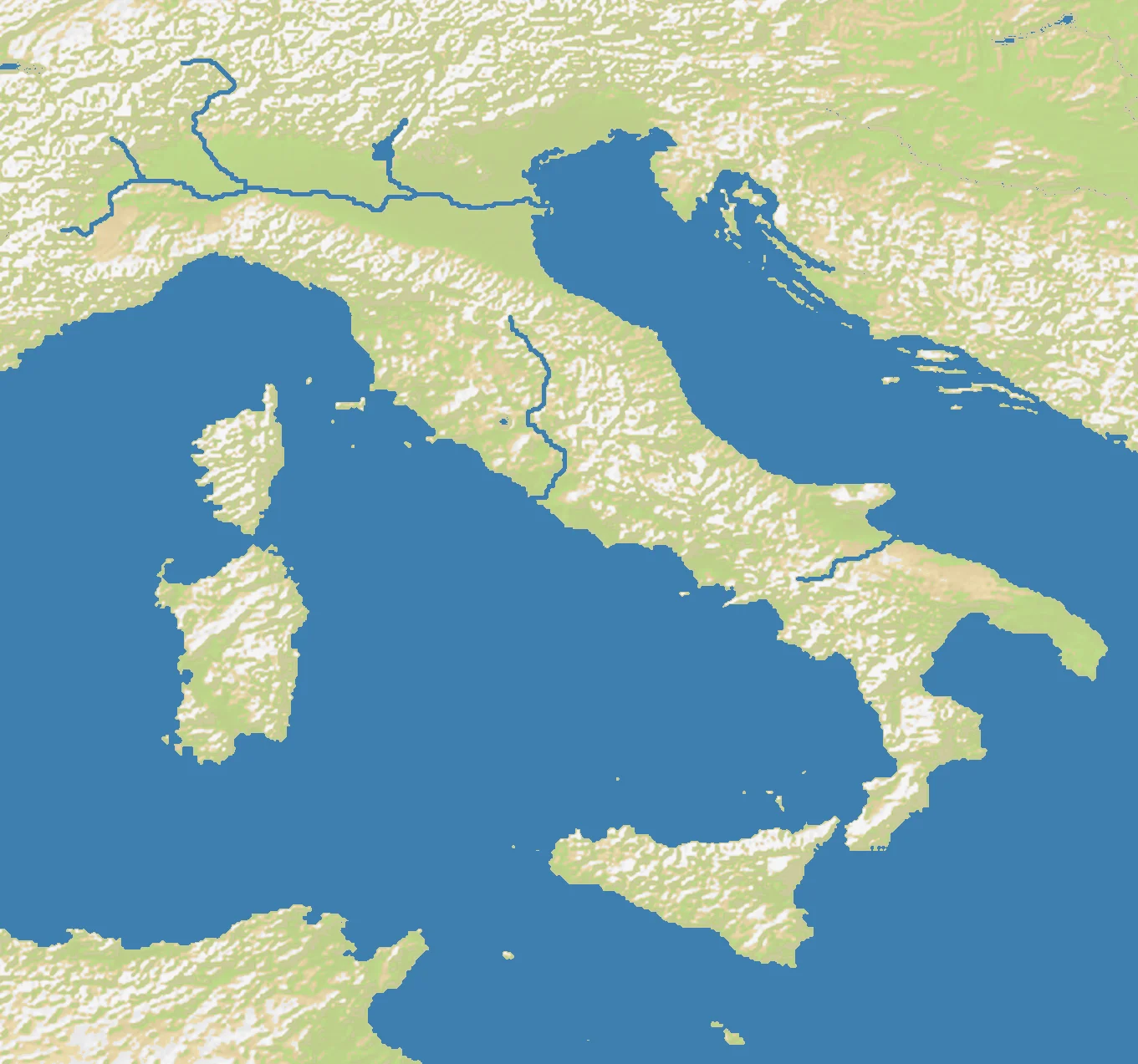
Italia is the Italian peninsula distilled into a compact strategic board. The OpenFront map is nearly square at 1360×1272, but the geography it captures is anything but simple: the Alps wall off the north, the Apennines run like a spine down the peninsula, and the long coasts open toward the Tyrrhenian, Adriatic, and Ionian seas. Land makes up 45% of the map, with 55% water pressing in from every side.
That combination produces one of Europe’s classic geographic paradoxes. Italy looks unified on paper, but mountains and seas divide it into natural regions: the Po Valley in the north, the central hill country around Tuscany and Rome, the south around Naples and Calabria, and the islands of Sicily and Sardinia beyond. Moving up and down the peninsula is possible, but lateral movement is often constrained.
The result is a map where the Alps are the shield, the seas are the temptation, and the peninsula itself is a long corridor that can become either an empire’s backbone or its trap.
The History
218 BCE — Rome Masters Italy
By the time of the Second Punic War, Rome had already subdued or allied with most of the peninsula. Italy’s central position in the Mediterranean let the Roman Republic project power outward into Africa, Spain, Greece, and eventually the wider empire.
1400s–1500s — The Age of City-States
Renaissance Italy was not one state but a mosaic of powers: Venice, Florence, Milan, Naples, the Papal States, and others. Wealth came from trade, banking, and maritime access, while mountains and rival coastlines kept political fragmentation alive.
1861 — The Risorgimento
The Kingdom of Italy was proclaimed in 1861 after decades of revolutions, diplomacy, and war. Unifying the peninsula required overcoming exactly the regional barriers the map still suggests: separate economic zones, local loyalties, and difficult north-south integration.
1943 — The Italian Campaign
After the Allied invasion of Sicily, the Second World War turned Italy into a brutal northward slog. Mountain defensive lines, narrow valleys, and exposed coasts made the peninsula a natural series of delaying positions.
The Battlefield
Terrain Overview
Italia is a corridor map with teeth. The Alps protect the north, the Apennines complicate internal movement, and long coastlines constantly threaten flanking invasions.
Best Spawns
- Po Valley — broadest land for rapid expansion and the best economic heartland on the map
- Central Tyrrhenian coast — balanced access north and south, with strong naval options toward both western and southern waters
- Sicily — island security plus command over the strait between mainland Italy and the central Mediterranean
Avoid
- Deep southern toe of Calabria — narrow, exposed, and vulnerable to being sealed off from the rest of the peninsula
- Far northeastern edge — can be pinned against the Alps and the Adriatic at the same time
Strategic Insights
Italy punishes linear overextension. If you charge too far down the boot without sea control, your front becomes thin and predictable; if you stay too naval, someone else will own the Po Valley and outgrow you.
Fun Facts
- Italy’s Apennines run for roughly 1,200 kilometers, creating a mountain spine almost the full length of the peninsula
- Sicily was the crossroads of Greek, Roman, Arab, Norman, and Spanish power before becoming part of modern Italy
- The map’s 1360×1272 dimensions make Italia one of the most compact major-peninsula battlegrounds in the atlas