Hawaii
Volcanic islands adrift in endless blue
Nations 9

The Geography
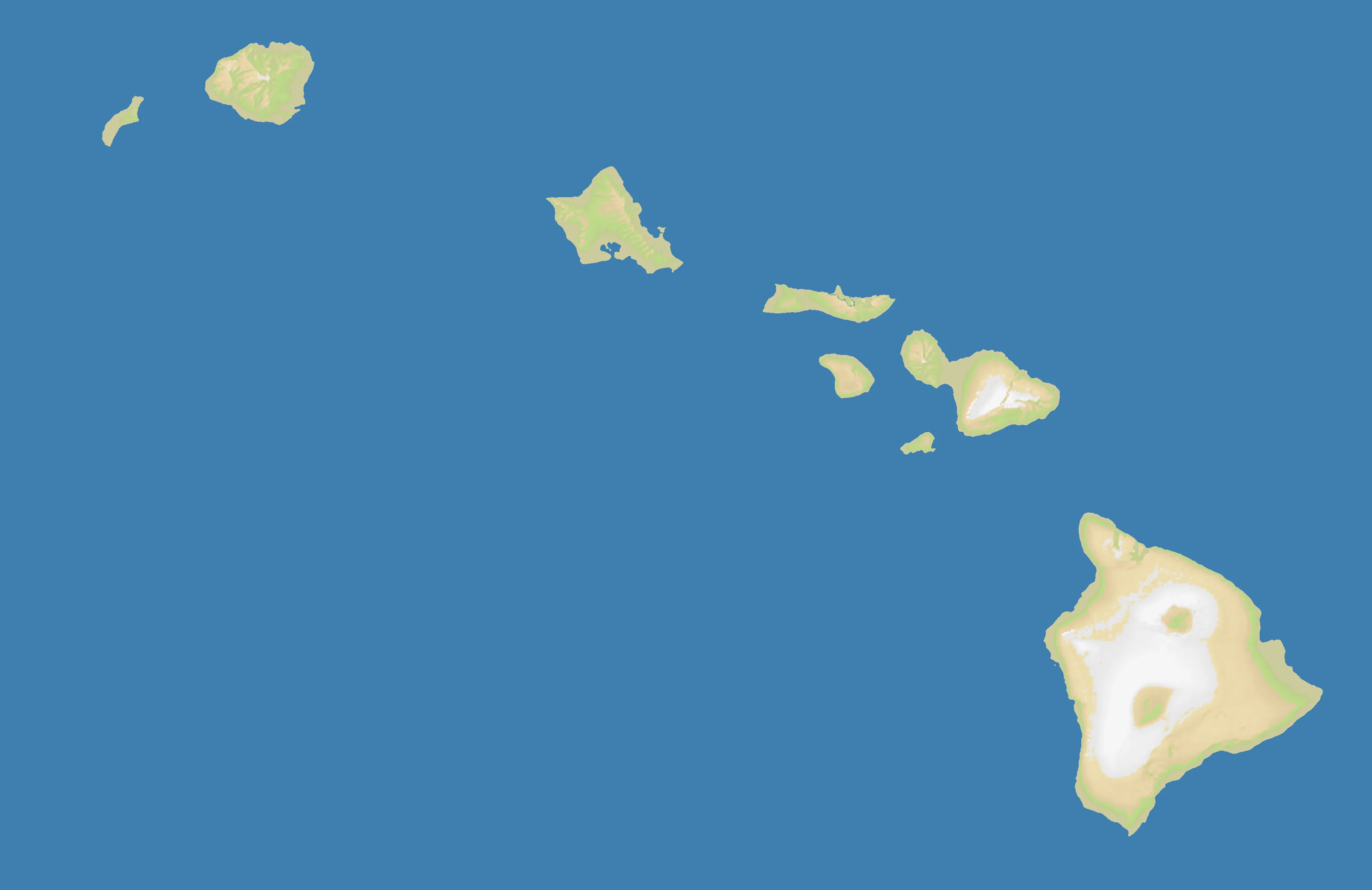
Hawaii is the most ocean-dominated real-geography map in OpenFront Atlas. The chain stretches across the central Pacific as a string of volcanic islands created by the Pacific Plate moving over a stationary hotspot. On the 3200×2076 Hawaii map, only 6% of the surface is land and a staggering 94% is water, making every island feel isolated, exposed, and strategically precious.
The main islands form a rough northwest-southeast arc: Kauai and Oahu in the west, Molokai, Lanai, and Maui in the center, and the massive Big Island to the southeast. Each island is mountainous, with narrow coastal plains wrapped around volcanic interiors. That matters in-game because the islands are close enough to tempt expansion, but far enough apart that no empire can ignore fleets for long.
Unlike continental maps, Hawaii has almost no interior depth. There are no great inland corridors, no forests to hide behind, no mountains that create long land fronts. Geography here is about harbors, crossings, and timing: whoever controls the sea controls the map.
The History
c. 1000 CE — Polynesian Settlement
Polynesian navigators crossed thousands of kilometers of open ocean using stars, swells, and bird patterns to settle the islands. Hawaii became one of the most isolated yet sophisticated seafaring societies on Earth.
1795 — Unification Under Kamehameha I
After years of warfare among rival chiefs, Kamehameha conquered most of the islands and created the Kingdom of Hawaii. Control of canoes, coastal landings, and inter-island movement was decisive — a pattern that fits the map perfectly.
1898 — American Annexation
The United States annexed Hawaii during the Spanish-American War, seeing the islands as a crucial Pacific coaling and naval station. From then on, Hawaii was less an isolated kingdom and more a forward base in an ocean-spanning strategic system.
1941 — Attack on Pearl Harbor
Japan’s surprise strike on Pearl Harbor brought the United States directly into World War II. Oahu’s naval position made Hawaii the hinge of the Pacific theater, and it remains one of the most militarily important island groups in the world.
The Battlefield
Terrain Overview
Hawaii is an exercise in naval logistics. With just 6% land, the map offers tiny footholds separated by broad channels, and the Big Island’s larger mass gives it a different rhythm from the smaller western islands.
Best Spawns
- Oahu — central location, strong access to multiple islands, historically the archipelago’s political and military heart
- Maui Nui zone — clustered islands create flexible expansion paths and shorter naval hops than the rest of the map
- Big Island — the largest landmass, better room to consolidate before projecting power outward
Avoid
- Outer western islands — easy to isolate, limited growth, and difficult to reinforce once fleets appear
- Tiny single-island starts — one setback at sea can end the game fast
Strategic Insights
This is the purest naval map in the atlas. You are not fighting for territory so much as for docking points: lose command of the water and even a strong island economy becomes a stranded fortress.
Fun Facts
- Hawaii is the most water-dominant real-world map in OpenFront Atlas at 94% ocean
- The islands exist because the Pacific Plate slides over the Hawaiian hotspot at a few centimeters per year
- Pearl Harbor on Oahu turned the islands into the best-known strategic outpost in the Pacific