Halkidiki
Three peninsulas, countless natural chokepoints
Nations 8


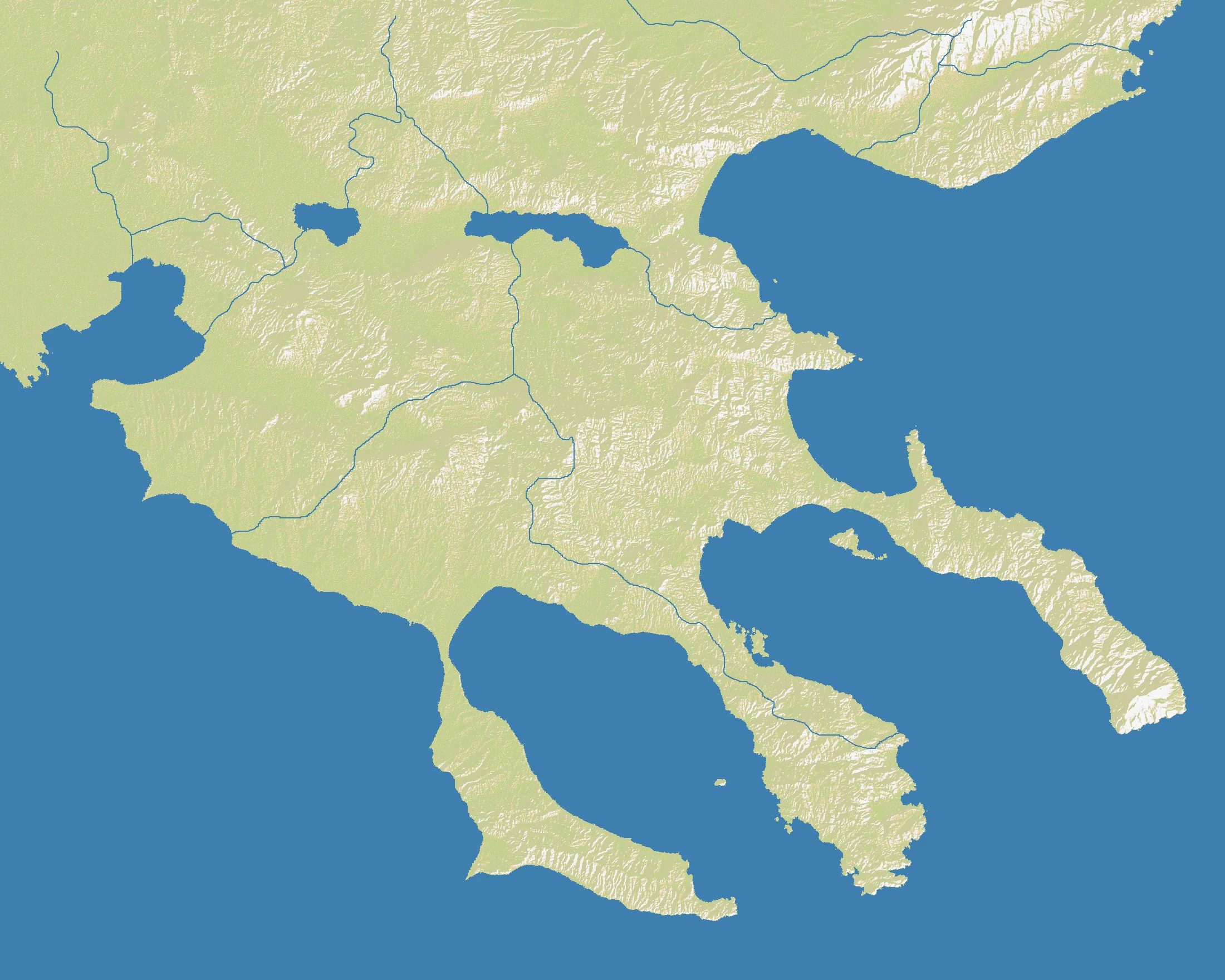
The Geography
Halkidiki is the distinctive three-pronged peninsula of northern Greece, projecting into the Aegean Sea southeast of Thessaloniki. Its “trident” shape is formed by Kassandra to the west, Sithonia in the middle, and the eastern Athos peninsula, whose tip is dominated by the monastic enclave of Mount Athos. Behind them lies the Macedonian mainland, tying the promontories back into the broader Balkans.
On the OpenFront map (2200×1760), land accounts for 45% of the battlefield. That gives Halkidiki an unusual balance for such a narrow and coastal region: it is maritime enough that crossings and shore control matter constantly, but land-heavy enough that the mainland and peninsula stems can sustain prolonged campaigns. With only 8 nations, each one has room to develop, yet the shape of the map ensures they will eventually collide at predictable bottlenecks.
The geography is all about branching routes. Each peninsula offers a semi-isolated lane of expansion, but they all narrow at the base and depend on surrounding waters for maneuver. That makes Halkidiki feel less like a wide-open Greek coast and more like three daggers attached to a single hilt.
The History
432 BCE — Potidaea and the Peloponnesian War
The ancient city of Potidaea, at the entrance to the Kassandra peninsula, became one of the sparks of the Peloponnesian War. Even in classical Greece, control of these narrow peninsular access points had outsized military and political significance.
356 BCE — Birth of Alexander’s Macedonian World
Alexander the Great was born nearby at Pella in the kingdom of Macedon, just northwest of Halkidiki. The region sat close to the power base that would launch one of history’s most spectacular campaigns of conquest.
885 CE — The Monastic Rise of Mount Athos
By the Byzantine period, the eastern peninsula of Athos had become a center of Orthodox monastic life. Its isolation, steep terrain, and spiritual prestige made it one of the most distinctive religious landscapes in Europe.
1912 — The First Balkan War
As Ottoman rule retreated from Macedonia and the Aegean, the surrounding region was contested by Balkan states seeking control of coasts, ports, and ethnic hinterlands. Halkidiki’s peninsulas sat at the edge of this larger struggle for northern Greek and Aegean space.
The Battlefield
Terrain Overview
Halkidiki is a branch-and-bottleneck map. The three peninsulas create natural lanes that are easy to identify and hard to hold all at once. The 45% land ratio gives armies room to matter, but the decisive feature is still geometry: narrow necks, long coasts, and the danger of being cut off on a peninsula you thought was safe.
Best Spawns
- Mainland base near the peninsula roots — control over the map’s hinge and access to all three prongs
- Central peninsula stem — balanced projection into both neighboring arms and surrounding waters
- Protected outer peninsula with strong shoreline — slower start, but excellent defensive shape if developed properly
Avoid
- Extreme peninsula tips — picturesque, but too easy to isolate and starve
- Single-access coastal pockets — one enemy blockade can turn them into traps
Strategic Insights
The temptation on Halkidiki is to treat each peninsula as a private kingdom. That usually fails. The real center of gravity is the shared base where the three arms connect to the mainland; control that hinge, and the outer prongs become manageable. Lose it, and even a large peninsula empire can be severed into helpless fragments.
Fun Facts
- Halkidiki has only 8 nations, but its 2200×1760 size makes it physically larger than many denser regional maps in this batch
- At 45% land, it sits between Gulf of St. Lawrence (40%) and Europe Classic (50%), combining naval tension with meaningful overland play
- The Athos peninsula is home to Mount Athos, one of the most unusual autonomous monastic regions anywhere on a real-geography OpenFront map