Gulf of St. Lawrence
Canada's river gate to the Atlantic
Nations 26


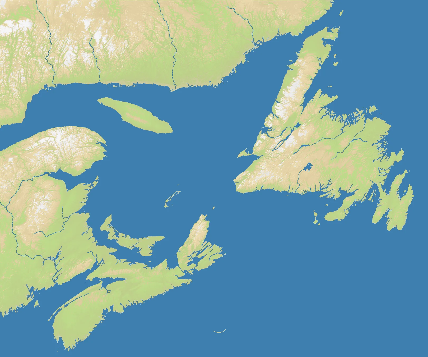
The Geography
The Gulf of St. Lawrence is the broad eastern basin where the St. Lawrence River system opens into the Atlantic. It is enclosed by Quebec to the north and west, New Brunswick and Nova Scotia to the south, Prince Edward Island near the center, and Newfoundland guarding the seaward approaches. In pure geographic terms, it is both gulf and gateway: an inland sea that also functions as the front door to the Canadian interior.
On the OpenFront map (1620×1348), land makes up 40% of the surface. That puts the Gulf of St. Lawrence in a middle category — clearly maritime, but not overwhelmingly oceanic like the Faroes or Falklands. Coastal campaigns, island staging, and strait control all matter, yet the surrounding provinces also provide enough solid ground for meaningful territorial buildup.
The region’s geography is defined by funnels. Ships enter through Cabot Strait or the Strait of Belle Isle, then move into a semi-enclosed basin with many coasts to raid and several islands to contest. That combination makes the gulf feel safer than the open Atlantic at first glance, but in practice it is an exposed inland sea where every shoreline is vulnerable.
The History
1534 — Jacques Cartier Enters the Gulf
French explorer Jacques Cartier sailed into the Gulf of St. Lawrence and up the great river, opening the route that would become the backbone of French Canada. Geography made the gulf not a peripheral bay, but the corridor into an enormous continental interior.
1608 — Founding of Quebec
Samuel de Champlain founded Quebec upriver, anchoring New France on the St. Lawrence system. Control of the gulf and river routes became essential for settlement, supply, trade, and defense.
1758 — The Siege of Louisbourg
British forces captured the fortress of Louisbourg on Cape Breton Island during the Seven Years’ War. That victory opened the St. Lawrence approaches and paved the way for the conquest of New France.
1942 — The Battle of the St. Lawrence
German U-boats entered the gulf during World War II, sinking ships in waters many Canadians had considered relatively secure. The campaign was a shock precisely because it revealed how vulnerable this inland maritime corridor really was.
The Battlefield
Terrain Overview
Gulf of St. Lawrence is a funnel map. Water is central, but it is constrained water, shaped by island positions, coastal pockets, and a few key entrances. The 40% land ratio means fleets must work with armies rather than replace them; you win by controlling the basin and then exploiting the land it exposes.
Best Spawns
- Cape Breton / central entrance zone — direct leverage over the main Atlantic approach into the gulf
- Southern Gulf coast — balanced access to islands, mainland, and interior sea lanes
- Newfoundland-facing approaches — strong ability to intercept incoming naval movement early
Avoid
- Deep western dead ends — decent local growth, but poor control over the gulf entrances
- Isolated island starts without mainland reach — tactically interesting, strategically brittle
Strategic Insights
This map rewards players who understand the difference between holding water and holding the doors to the water. Dominating the outer entrances lets you tax everyone inside, but overcommitting there can leave the inner gulf vulnerable to a rival who builds a stronger land base. Gulf of St. Lawrence is at its best when you play it as a layered theater: outer approach, inner basin, then riverward consolidation.
Fun Facts
- At 40% land, Gulf of St. Lawrence is significantly wetter than Europe Classic (50%) but far more grounded than Faroe Islands (13%) or Falkland Islands (29%)
- Historically it was the maritime highway of French Canada, making it one of the clearest river-to-ocean gateway maps in the atlas
- With 26 nations, it is one of the busiest regional maps in this batch despite covering a relatively specific corner of eastern Canada