Gateway to the Atlantic
Where Europe opens onto the ocean
Nations 30


The Geography
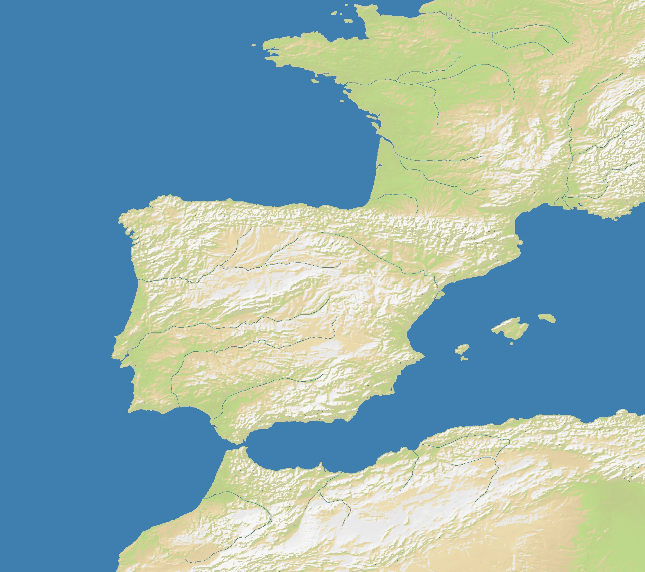
Gateway to the Atlantic appears to cover the great hinge between continental Europe and the open Atlantic world: the British Isles guarding northern access, Iberia thrusting southwestward, island stepping stones such as the Azores or nearby Atlantic positions, and the northwestern African coast forming the southern wall. This is not a single narrow chokepoint like Gibraltar, but a broad maritime threshold where ships leave European coastal waters and enter oceanic space.
On the OpenFront map (2216×1968), land and sea are nearly balanced at 51% land. That gives the theater unusual flexibility. There is enough continental mass for sustained land campaigns across Iberia, the British Isles, and adjacent coasts, but enough water for naval strategy to matter constantly rather than occasionally.
What makes the geography special is its layered connectivity. Sea lanes run north-south and east-west; peninsulas create launch points; islands act as advanced outposts; and coastlines are long enough that no one can guard them all. It is a map about access — to the Atlantic, to Europe, and to the trade and invasion routes between them.
The History
1588 — The Spanish Armada
Spain’s attempt to invade England turned the Atlantic approaches and Channel-adjacent waters into the decisive theater of European power politics. The campaign showed that command of the gateway waters could determine whether continental ambition reached the islands or died at sea.
1805 — Trafalgar
Nelson’s victory off Cape Trafalgar confirmed British command of the seas around Iberia and the Atlantic approaches. From then on, maritime supremacy at Europe’s ocean gate became one of the foundations of British global power.
1917 — The Convoy System in World War I
German U-boats threatened Britain’s Atlantic lifeline, forcing the Allies to organize escorted convoys through the western approaches. Geography again dictated strategy: whoever protected or interdicted these routes shaped the survival of island Britain.
1941–1945 — Battle of the Atlantic
In World War II, the gateway region became the front door of the Atlantic convoy war. Bases, air cover, island positions, and coastal routes around Britain, Iberia, and the eastern Atlantic all mattered in the long struggle to keep shipping moving.
The Battlefield
Terrain Overview
Gateway to the Atlantic is a hybrid theater. Large landmasses create real continental campaigns, but the map’s logic is maritime: the side that controls the approaches can raid, reinforce, and redistribute force faster than anyone boxed inland. The 51% land ratio keeps the map balanced, but not neutral — naval awareness is mandatory.
Best Spawns
- Western Iberia — strong land base with immediate projection into Atlantic lanes
- Southern Britain / western approaches — excellent access to central sea traffic and multiple landing options
- Strategic island outposts — high-risk, high-reward starts that can dominate transit routes if stabilized early
Avoid
- Deep inland coastal cul-de-sacs — enough land to expand, but poor ability to shape ocean traffic
- Overexposed micro-islands without nearby support — powerful only if you survive the opening dogpile
Strategic Insights
This map favors players who think in theaters rather than fronts. You are not just conquering neighbors; you are contesting the movement network that connects continents, islands, and trade routes. Strong Atlantic positions can pressure everyone at once, but they also attract coalitions, so the smartest path is often to build quietly on land while preparing a sudden breakout into the sea lanes.
Fun Facts
- At 2216×1968, Gateway to the Atlantic is one of the largest regional maps in this batch, larger than East Asia, Falkland Islands, or Gulf of St. Lawrence
- Its 51% land ratio puts it almost exactly beside Europe Classic (50%), but its gameplay is far more maritime in emphasis
- Historically, this region links some of the atlas’s most famous naval stories: the Armada, Trafalgar, and the Battle of the Atlantic all belong to the same grand approach zone