Faroe Islands
Tiny islands in a giant unforgiving ocean
Nations 6

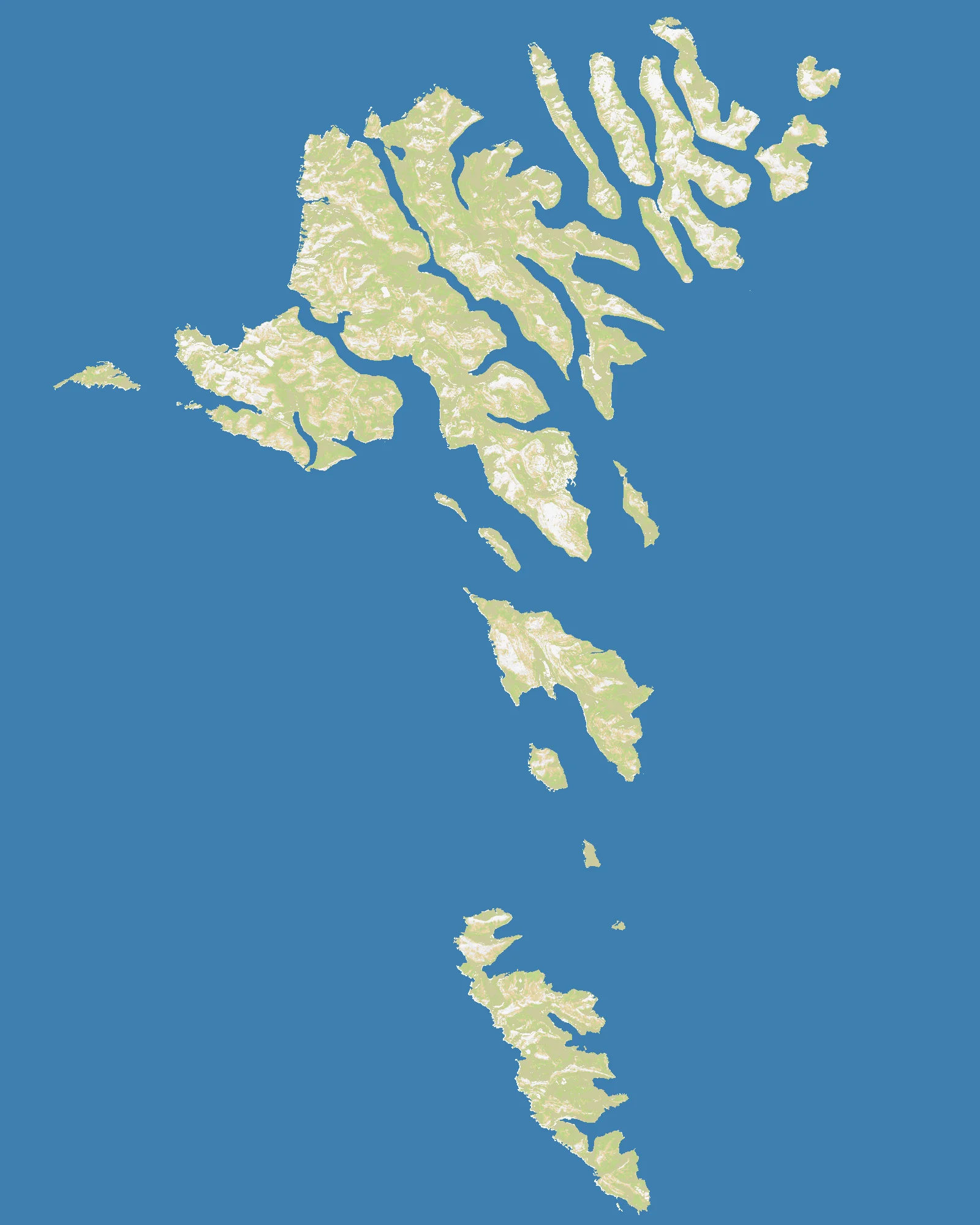
The Geography
The Faroe Islands are a small North Atlantic archipelago lying roughly halfway between Norway and Iceland, with Scotland not far to the south. There are 18 major islands, but they feel less like a chain and more like shattered pieces of volcanic land thrust out of the sea. Steep cliffs, narrow fjords, abrupt mountains, and rough surrounding waters give the Faroes a dramatic scale far larger than their actual size.
On the OpenFront map (1600×2000), just 13% of the surface is land. That makes Faroe Islands one of the most ocean-dominant real-geography maps in OpenFront — second only to the wettest extremes of the atlas. With only 6 nations, the map is sparse in population but not in danger; distance, exposure, and stormy maritime geometry do the work that crowding does on denser maps.
Because the islands are so fragmented, every piece of land matters. There is very little continuous territory to build a secure core, and even adjacent islands may be functionally separated by awkward sea lanes. The Faroes are less a normal regional map than a lesson in how harsh maritime geography can turn tiny scraps of land into strategic worlds unto themselves.
The History
9th Century — Norse Settlement
Vikings settled the Faroes during the early medieval North Atlantic expansion, drawn by fisheries and stepping-stone routes across the ocean. Their arrival linked the islands into the wider Norse maritime world that also included Iceland, Norway, and the British Isles.
1380 — Union Under the Danish Crown
When Denmark and Norway entered dynastic union, the Faroes ultimately came under the Danish crown. That long constitutional connection shaped the islands’ language politics, trade patterns, and modern autonomy debates.
1940 — British Occupation in World War II
After Germany occupied Denmark, Britain moved quickly to occupy the Faroes to prevent Axis use of the islands and nearby sea routes. Even this tiny archipelago suddenly mattered because the North Atlantic was the logistical lifeline of the Allied war effort.
1948 — Home Rule Established
Faroe Islands gained home rule within the Kingdom of Denmark after a period of intense political debate and a disputed independence referendum. The result preserved Danish sovereignty while recognizing the islands’ distinct identity and self-government.
The Battlefield
Terrain Overview
Faroe Islands is a survival map built on water separation. The 13% land ratio means almost every meaningful move involves a crossing, and the low nation count gives each player room to breathe only until someone masters the sea lanes. Chokepoints exist, but they are maritime rather than continental.
Best Spawns
- Central island cluster — best balance of connectivity, interception potential, and short reinforcement routes
- Large island with multiple nearby crossings — enough land to scale while still projecting into the archipelago core
- Mid-outer positions facing inward — a good compromise between safety and access to the decisive center
Avoid
- Extreme edge islands — too easy to ignore early and too hard to leverage later
- Tiny split holdings — expansion looks flexible on paper, but defense becomes impossible after the first setback
Strategic Insights
Faroe Islands punishes overconfidence more than aggression. Because there are only 6 nations, the map can look calm at first — but once one player assembles superior naval mobility, island chains start falling in sequence. The winning approach is to secure a connected mini-empire, dominate the central crossings, and never let yourself become a collection of isolated rocks.
Fun Facts
- At just 13% land, Faroe Islands is the second most ocean-dominant real-geography map mentioned in this batch
- It has only 6 nations, fewer than any other map in this set, yet its fragmentation can make it feel trickier than much larger theaters
- Faroe Islands is even wetter than Falkland Islands (29%) and Gulf of St. Lawrence (40%), making it one of the purest naval maps in the atlas