Europe
The most contested peninsula on Earth
Nations 49


The Geography
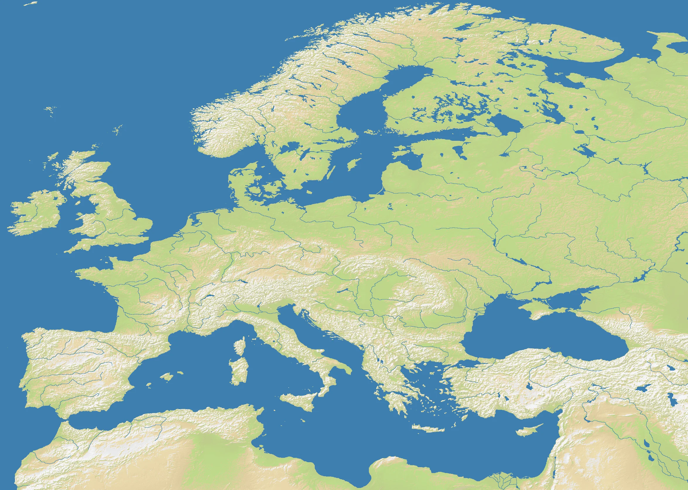
Europe punches far above its size. Covering barely 10 million square kilometers, it nonetheless contains more recognized sovereign states than any other continent — a fact the map’s 49 nations reflects accurately. The terrain on the OpenFront map captures the key geographical reality: a heavily indented western coastline, a central mountain spine (the Alps and Carpathians), broad northern plains, and the Mediterranean’s island-studded southern edge.
At 58.9% land — the highest ratio among the continental maps — Europe is unusual: relatively little ocean, a lot of closely-packed territory. The Rhine, Danube, and other river corridors are baked into the terrain, and the Scandinavian peninsula’s jagged coast creates natural defensive positions in the north. The Iberian and Italian peninsulas jut into the sea as semi-isolated extensions, tempting to grab early but hard to defend long-term.
The History
44 BCE — Rome at Its Peak
The Roman Empire unified most of Western Europe under a single administrative system for the first time. Its road network, legal code, and Latin language became the substrate on which every subsequent European civilization was built. The boundaries it drew — Rhine and Danube as the northern frontier — still shape regional identities on this map.
800 CE — Charlemagne’s Empire
For a brief moment, the Frankish king reunited what Rome had lost. His empire’s east-west division after his death produced the rough outlines of modern France and Germany — two of the game’s most frequently contested spawn zones on this map.
1648 — The Peace of Westphalia
Thirty years of religious war ended with a treaty that formalized the modern concept of the nation-state — sovereign territories with fixed borders and non-interference norms. Every nation on this map is, in a sense, the product of that settlement.
1914–1945 — The European Civil War
Two catastrophic wars in thirty years killed tens of millions and destroyed the continental order. The borders that emerged in 1945 — and the Cold War division between West and East — are essentially the political map that OpenFront’s Europe map is drawn from.
The Battlefield
Terrain Overview
Europe’s 58.9% land density makes it one of the most land-intensive continental maps. The Alps create a hard divide between Northern and Southern Europe — controlling the passes is critical. The wide Northern European Plain (Poland through France) is a natural highway for fast expansion, but also a killing ground with no natural barriers.
Best Spawns
- Scandinavia — excellent defensive geography, mountain barriers, ocean flanks; expand south at pace
- Iberian Peninsula (Spain/Portugal) — semi-isolated starting position, room to consolidate, then strike through France
- UK / Britannia position — island start gives breathing room; naval control of the Channel is powerful early
Avoid
- Central Europe (Austria/Hungary corridor) — surrounded on all sides, no natural defense, first to get squeezed in multi-front wars
- Eastern European flatlands — open terrain with threats from multiple directions; early game can collapse quickly
Strategic Insights
The 41.1% water coverage makes coastal and Channel control meaningful but not dominant — this is primarily a land war map. Naval transport becomes useful for crossing the Mediterranean or striking the Baltic coast, but you won’t win through sea power alone. At playlist frequency 3, Europe appears infrequently, making each game feel like an event. The high nation density (49 nations) guarantees early skirmishes and rapid territorial consolidation in the first phases.
Fun Facts
- Europe has the highest land percentage (58.9%) of any continental map — it’s almost exactly the inverse of Oceania (9.7% land)
- At 49 nations, it ties North America for second-most nations among continental maps
- The Alps terrain feature creates some of the game’s most pronounced mountain chokepoints, mimicking the historical importance of Alpine passes