Between Two Seas
The Caucasus corridor between Black and Caspian
Nations 15


The Geography
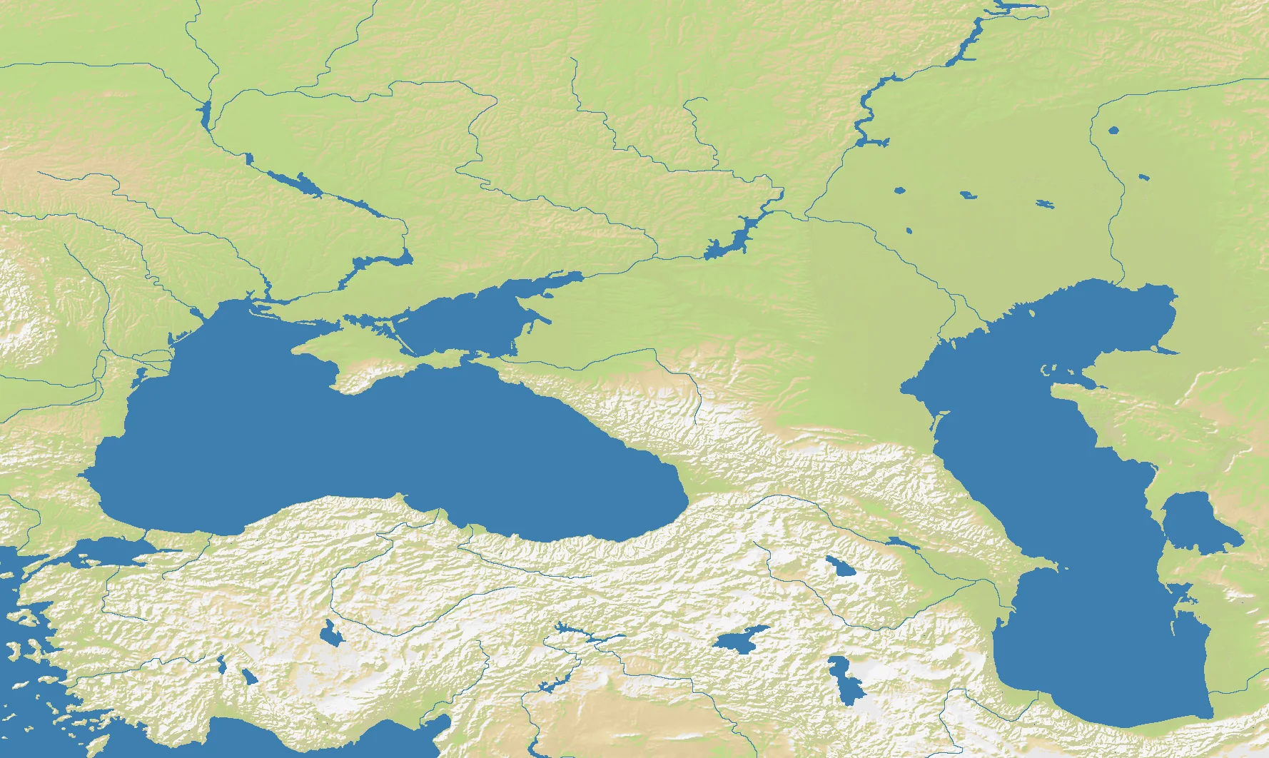
Between Two Seas is the great land bridge between the Black Sea and the Caspian Sea: Anatolia to the south and west, the Caucasus at the center, the Crimean and Pontic approaches to the northwest, and the Caspian basin to the east. The map’s 1776×1060 layout is wide enough to show both enclosed maritime worlds at once, with the corridor between them becoming the obvious strategic prize.
At 79% land, this is one of the most land-dominant regional maps in OpenFront. That matters because the two seas are not broad open theaters so much as anchors on either side of a largely terrestrial struggle. The Caucasus Mountains, eastern Anatolian uplands, Crimean approaches, and river-fed lowlands around the north all create competing routes through a region famous for choke-based warfare.
With 15 nations, Between Two Seas is busy without becoming pure chaos. The density is high enough that the central Caucasus can erupt immediately, but there is still room for flanking development through Anatolia, the north Black Sea steppe, or the western Caspian shore. It feels like a hinge map: whoever controls the hinge can swing power into multiple regions.
The History
c. 8th–6th Centuries BCE — Greek Colonies Ring the Black Sea
Greek settlers founded trading cities all around the Black Sea littoral, tying the Caucasus and Pontic world into Mediterranean commerce. The region between the Black and Caspian seas became a contact zone where steppe, mountain, and maritime civilizations met.
337 CE — Iberia and Armenia Become Christian Kingdoms
The South Caucasus was one of the earliest regions in the world to adopt Christianity as a state religion. That mattered geopolitically because the corridor sat between Roman-Byzantine influence, Persian imperial power, and later Islamic expansion.
1555 — The Peace of Amasya Divides Ottoman and Safavid Spheres
The Ottoman and Safavid empires formalized a frontier through eastern Anatolia and the Caucasus after decades of war. The settlement demonstrated the region’s enduring role as a contested hinge between Anatolian, Iranian, and steppe power systems.
19th Century — Russia Conquers the Caucasus
Imperial Russia fought prolonged wars to secure the Caucasus and push toward the Black Sea and Caspian littorals. The campaign was brutal and transformative, binding the region into a northern empire while leaving a legacy of resistance and ethnic complexity that still shapes politics today.
The Battlefield
Terrain Overview
This map is defined by connective tissue. The seas limit movement on the flanks, but the real struggle happens across the corridors between them: the north shore approaches, the passes and foothills of the Caucasus, and the Anatolian plateaus to the south. Because the map is 79% land, sustained territorial expansion matters more than fleet play, even though the water still creates useful anchors.
Best Spawns
- Central Anatolian / eastern Anatolian approaches — strong land continuity and excellent access to both Black Sea and Caucasus theaters
- Western Caucasus foothills — defensible terrain with immediate influence over the central hinge of the map
- North Black Sea corridor — room to grow and good leverage over routes into Crimea, the Caucasus, and the Caspian side
Avoid
- Tight central mountain pockets — easy to defend briefly, but hard to expand from once neighbors consolidate the lowlands
- Far eastern Caspian-edge corners — safer at first, but strategically peripheral if the center hardens against you
Strategic Insights
Between Two Seas rewards players who think in terms of transit, not territory count alone. The key is to control the connections between basins: if you dominate the land bridge, both seas become your flanks rather than your obstacles. On a 15-nation map with 79% land, the winner is often the player who turns geography into a funnel and forces everyone else to attack uphill or through a narrowing corridor.
Fun Facts
- This is one of the most land-heavy regional maps in OpenFront at 79% land, despite being named for two major seas
- The map effectively combines parts of Black Sea and inland Caucasus geography into a broader strategic theatre than the dedicated Black Sea map
- Its 1776×1060 shape makes it feel like a hinge between worlds — not quite continental, not quite maritime, but something awkward and dangerous in between