Bering Strait
Two shores, one choke point, no distractions
Nations 2


The Geography
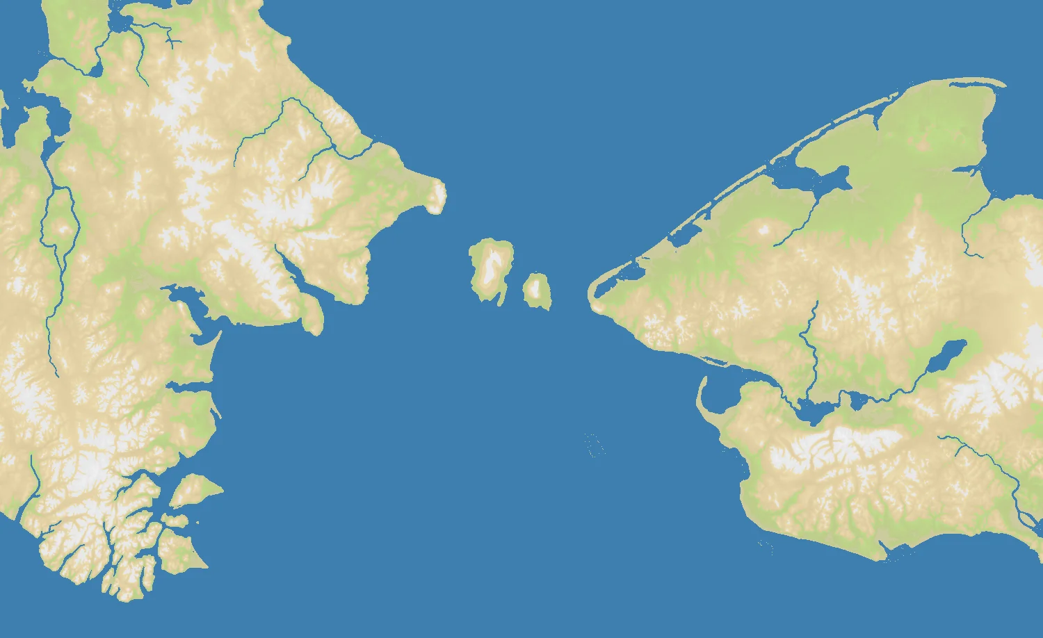
The Bering Strait is the narrow maritime gap between northeastern Siberia and western Alaska, linking the Pacific Ocean to the Arctic through the Bering and Chukchi Seas. At its tightest point it is only about 85 kilometers wide, and in the middle sit the Diomede Islands — tiny dots with enormous symbolic weight. The OpenFront Bering Strait map captures this gateway in a compact 1500×916 frame that keeps both shores visible at once.
At 43% land, water slightly dominates the map, which is exactly right for a region defined by separation and connection at the same time. The Alaskan side is rugged and remote, the Siberian side broad and austere, and the strait itself is the decisive feature. There are no secondary theatres here, no distant rear areas, and no clutter of small powers.
That is because this map has only 2 nations. Bering Strait is pure 1v1 OpenFront: one opponent, one frontier, one set of crossing decisions. The geography strips strategy down to essentials — timing, lane control, and whether you can force the decisive break before the other side does.
The History
c. 15,000 Years Ago — Beringia Links Asia and the Americas
During the last Ice Age, lower sea levels exposed the landmass known as Beringia, connecting Siberia and Alaska. Human migration across or through that region helped populate the Americas, making this one of the most consequential geographic corridors in human history.
1728 — Vitus Bering Charts the Strait
Danish explorer Vitus Bering, sailing for Russia, helped confirm that Asia and North America were separated by water. His voyage gave the strait its modern name and fixed the region on imperial maps.
1950s — The Cold War Freezes the Frontier
The Soviet Union and the United States faced each other across this narrow gap, turning the Bering Strait into a hard edge of the bipolar world. Radar networks, Arctic patrols, and military planning gave huge strategic weight to a place with almost no population.
21st Century — A Potential Shipping Bottleneck Emerges
As Arctic sea ice changes, the Bering Strait has gained new significance as a possible shipping chokepoint between Pacific and Arctic routes. Once again, a seemingly marginal passage is becoming central to debates about trade, sovereignty, and access.
The Battlefield
Terrain Overview
This map is built around the crossing. The side coasts matter, but only insofar as they let you stage, feint, or defend the main approach. Because there are just two nations and 43% land, the match quickly becomes a test of whether the strait acts as a shield, a bridge, or a death trap.
Best Spawns
- Any position with direct access to the central crossing lane — this is a 1v1 map, so initiative matters more than flank variety
- Slightly interior shore positions — enough depth to defend while still contesting the strait quickly
Avoid
- Extreme backline corners — too passive on a map where tempo decides everything
- Overextended forward starts without depth — you may touch the choke first, but you can also collapse first
Strategic Insights
On most maps, you can recover from a bad first contact by pivoting elsewhere. Not here. Bering Strait is brutally honest: scout the crossing, protect your reinforcement path, and choose carefully when to commit. With only one enemy on the board, every move is legible — which means deception and timing become the real advanced skills.
Fun Facts
- Bering Strait is the simplest strategic setup in OpenFront: exactly 2 nations and no diplomatic ambiguity at all
- The Diomede Islands in the real strait are separated by only a few kilometers, yet also by the US-Russia border and the International Date Line zone
- Compared with sprawling maps like Asia or Arctic, Bering Strait plays almost like a duel arena built out of real geography