Africa
The world's most ancient continent
Nations 36


The Geography
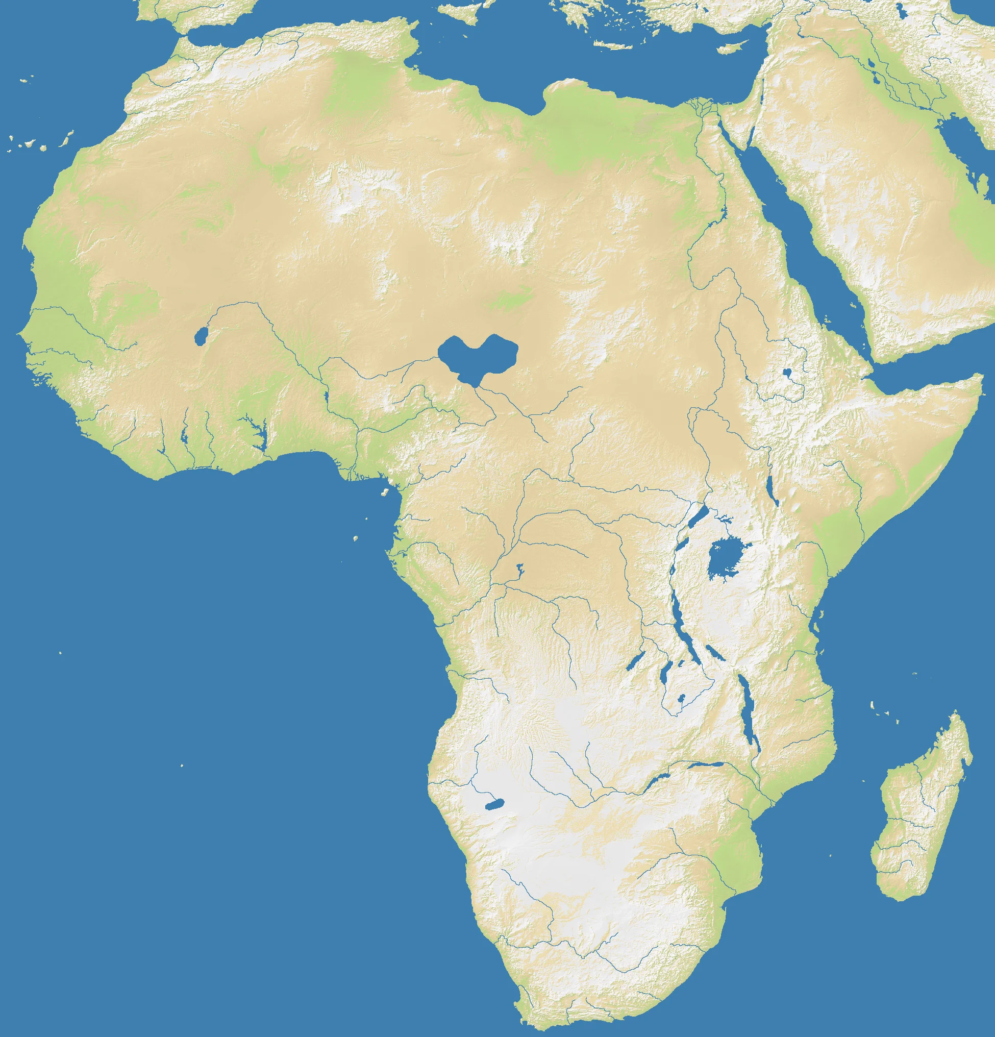
Africa is a continent of extremes. The world’s largest hot desert (Sahara) occupies the entire northern third of the map. Below it, a broad Sahel transition zone gives way to the Congo Basin — the world’s second-largest tropical rainforest. Further south, the terrain shifts again: the Great Rift Valley slashes through East Africa, the Kalahari occupies the southwestern interior, and the Cape of Good Hope marks the continent’s southern tip.
On the OpenFront map (1948×2032), this diversity translates into genuine terrain variety. At 55.2% land, Africa is one of the more land-dominant maps. The massive Saharan north creates an unusual dynamic: enormous, relatively empty territory that takes time to cross. The Congo interior creates dense, low-movement terrain in the center. Coastal positions around the Gulf of Guinea, East African seaboard, and Mediterranean rim all offer different strategic profiles.
The History
3100 BCE — Pharaonic Egypt
The Nile Valley civilization was among the earliest complex states on Earth. Its annual floods made the narrow river corridor one of the most productive agricultural zones in the ancient world — a strip of green cutting through the Saharan expanse that defines the northeastern corner of this map.
7th Century CE — The Arab Conquests
Within a century of Muhammad’s death, Arab armies swept across North Africa, converting the population to Islam and fundamentally reshaping the cultural landscape from Egypt to Morocco. The Sahara became a boundary between an Arabic-speaking Muslim north and sub-Saharan Africa — a divide that the map’s terrain geometry echoes.
1884 — The Berlin Conference
European powers divided Africa among themselves at a conference where no Africans were present. The resulting “Scramble for Africa” imposed artificial borders that cut across ethnic groups, rivers, and trade networks. Most of the nation boundaries visible on this map trace directly back to those colonial-era lines.
1960s — The Year of Africa
Seventeen African nations gained independence in 1960 alone. The decolonization wave that followed reshaped the continent’s political map, creating the diverse range of nations that populates the OpenFront Africa map.
The Battlefield
Terrain Overview
Africa’s most defining gameplay feature is the Sahara — a vast, difficult-terrain expanse that slows movement and punishes overextension northward. The Mediterranean coast and Nile Delta are the main entry points into the continent from the north. The eastern Great Rift Valley corridor creates a natural highway running north-south through East Africa.
Best Spawns
- West Africa (Gulf of Guinea coast) — excellent naval access, high land density, strong expansion into sub-Saharan interior
- Southern Africa (around the Cape) — isolated southern tip, protected flanks, time to build before northern pressure arrives
- East Africa Rift Corridor — access to both the Horn of Africa and Central/Southern expansion, the map’s natural spine
Avoid
- North Africa (Sahara interior) — massive distances, slow movement, starved for neighbors early
- Sahel edge nations — caught between Sahara emptiness to the north and dense competition to the south
Strategic Insights
The Sahara acts as a natural buffer zone — controlling the northern edge is important for blocking cross-continental invasions, but committing troops there is expensive. The continent’s coastal perimeter rewards naval investment: the Gulf of Guinea, East African coast, and Cape Horn position all enable coastal raiding and supply disruption. At playlist frequency 7, Africa is one of the more common continental maps.
Fun Facts
- Africa at 55.2% land is the third most land-dense continental map, behind Europe (58.9%) and Asia (45%)
- The Nile River’s narrow corridor through the Sahara is one of the most striking terrain features across all OpenFront maps
- At 110 estimated max players, Africa is tied with Europe and Oceania as one of the highest-capacity continental maps