Aegean
Where islands turn the sea into terrain
Nations 29


The Geography
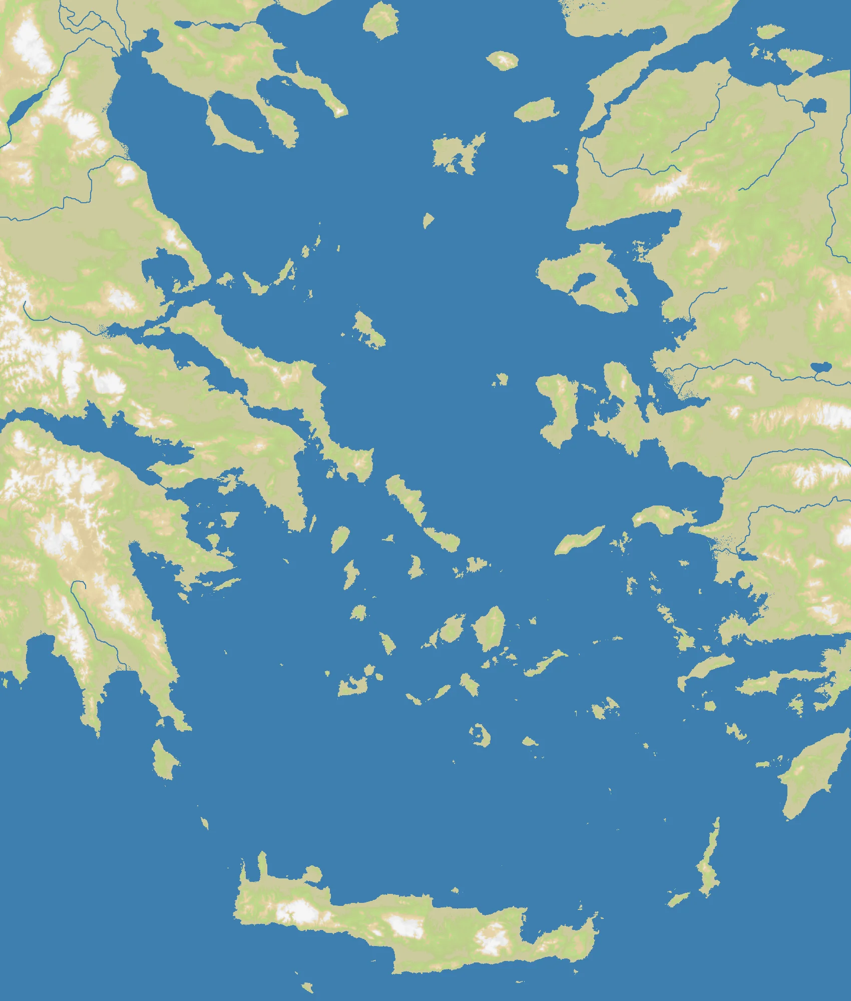
The Aegean is not a single open sea so much as a shattered maritime labyrinth. It lies between the Greek mainland to the west and Anatolia — modern Turkey — to the east, with the Cyclades, Dodecanese, North Aegean islands, Crete, Euboea, and countless smaller islands breaking the water into channels, straits, and island-hopping corridors. The OpenFront Aegean map uses a tall 1700×2000 frame that emphasizes the north-south reach from Thrace and Macedonia down toward Crete and the eastern Mediterranean approaches.
At just 34% land, this is one of the wetter regional maps in the game. That number matters: 66% of the battlefield is sea, so coastlines are not edges but front lines. Narrow crossings around the Dardanelles, the Sporades, the Cyclades, and the Anatolian shore become the real terrain. Mainland Greece offers mountain-backed peninsulas, while western Turkey provides longer continuous coast and broader land connections.
The geography that made the Aegean famous historically also makes it tactically volatile here. Islands can protect you for a while, but they also fragment your expansion. With 29 nations packed into this island-heavy region, the early game becomes a contest over ferries, chokepoints, and which side of the sea you can dominate first.
The History
c. 1600 BCE — Minoans and Mycenaeans Dominate the Aegean
The Bronze Age civilizations of Crete and mainland Greece built the first major palace societies in the region and turned the Aegean into a trading highway. Control of islands, harbors, and short sea lanes mattered long before classical Greece existed.
478 BCE — The Delian League Becomes an Athenian Maritime Empire
After the Persian Wars, Athens organized an alliance centered on the Aegean islands. In practice it became a naval empire funded by tribute, proving that command of this sea could translate directly into political dominance over dozens of scattered communities.
1204 — Constantinople Falls to the Fourth Crusade
When crusaders and Venetians captured Constantinople, the Byzantine world fractured and the Aegean filled with Latin duchies, Venetian ports, and contested islands. The event permanently altered the balance of power between Greek, Italian, and later Turkish forces in the region.
1922 — The Greco-Turkish War Ends in Catastrophe
The collapse of the Greek campaign in Anatolia ended with the burning of Smyrna and a massive population exchange between Greece and Turkey. Modern national borders around the Aegean were hardened by that trauma, but the sea remained a strategic fault line between the two states.
The Battlefield
Terrain Overview
The Aegean’s defining feature is fragmentation. There is no single secure core: the Greek mainland is cut by gulfs and mountain chains, the islands come in vulnerable clusters, and the Anatolian coast creates long exposed shorelines. The Dardanelles and the northern chokepoints near the Sea of Marmara are especially important because they connect the Aegean to the Black Sea world.
Best Spawns
- Western Anatolian coast — more continuous land than the islands, multiple expansion directions, and strong access to both central and northern Aegean routes
- Central Greece / Attica-Euboea zone — central position, dense island network nearby, and fast access to both mainland and naval play
- Crete or the southern island belt — separated from the northern scrum, easier to consolidate before pushing back into the archipelago
Avoid
- Tiny central island clusters — surrounded from all sides, difficult to defend once neighbors establish fleets
- Far northern corners near the straits — strategically important but immediately crowded on a 29-nation map
Strategic Insights
This is a naval map even more than it first appears. Because only 34% of the map is land, you cannot think in terms of one continuous front; you need layered control over channels and island chains. The best players use islands as stepping stones rather than homes: consolidate one cluster, jump to the next, and deny opponents freedom of movement across the middle of the sea.
Fun Facts
- At 29 nations, Aegean is one of the most crowded regional naval maps in OpenFront despite covering a relatively compact real-world space
- Its 34% land share makes it far more water-dominated than Black Sea, even though both are eastern Mediterranean-adjacent maps
- The map’s portrait-style 1700×2000 layout mirrors the real Aegean’s long north-south chain of seas, straits, and islands